Idalgashinna Mountain
A scenic ridge hike near Idalgashinna Railway Station with sweeping views of tea estates, valleys, and the iconic hill country railway line.
Distance
Difficulty
Best Time to Visit
Entrance Fee
Overview
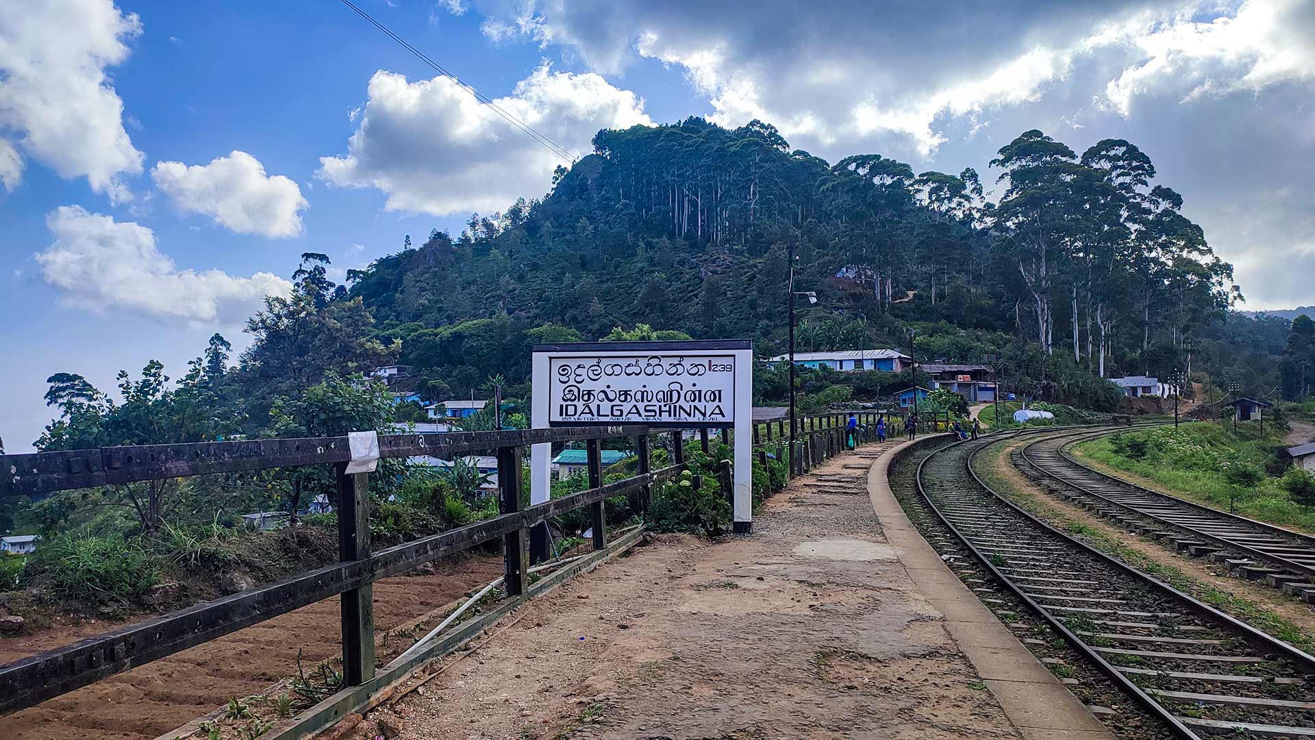
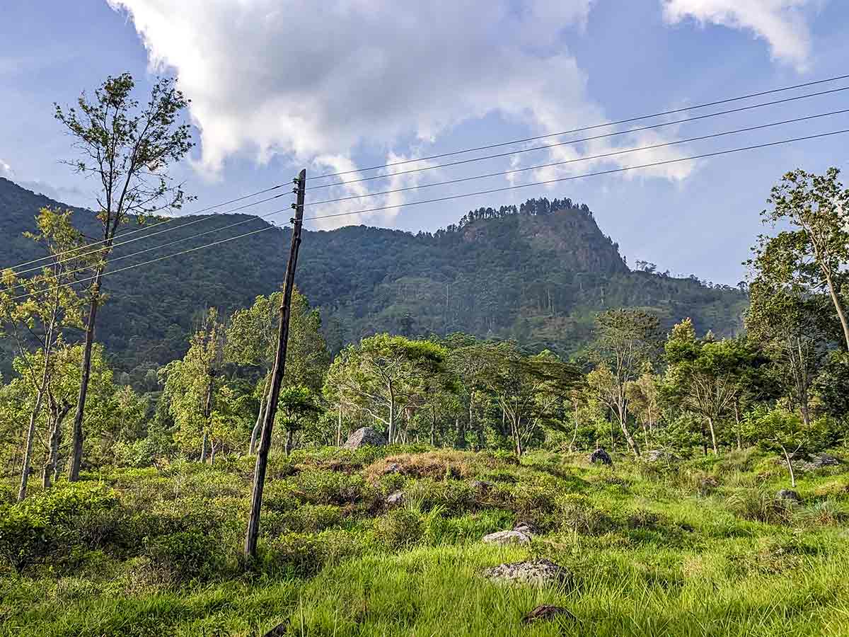
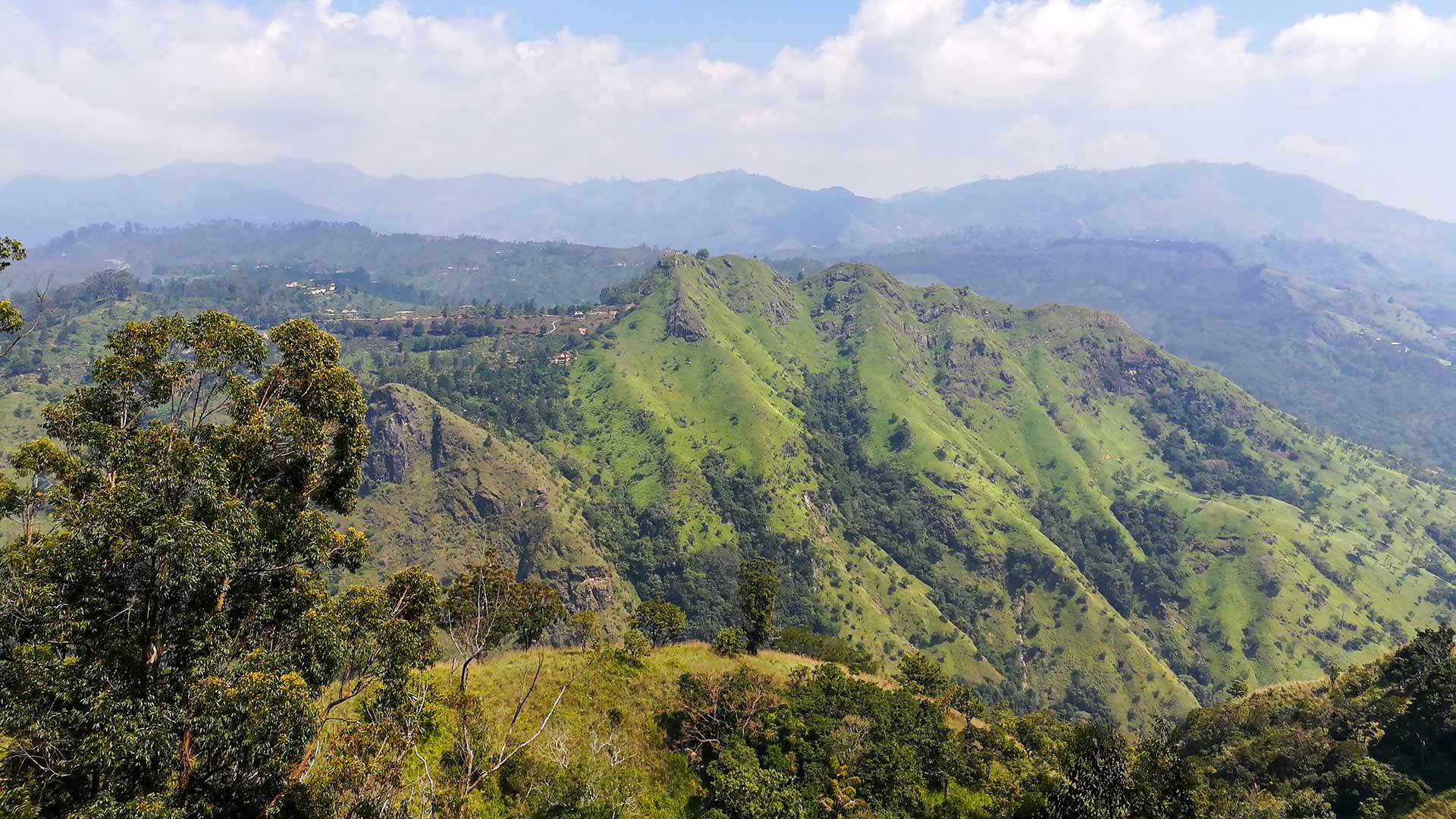
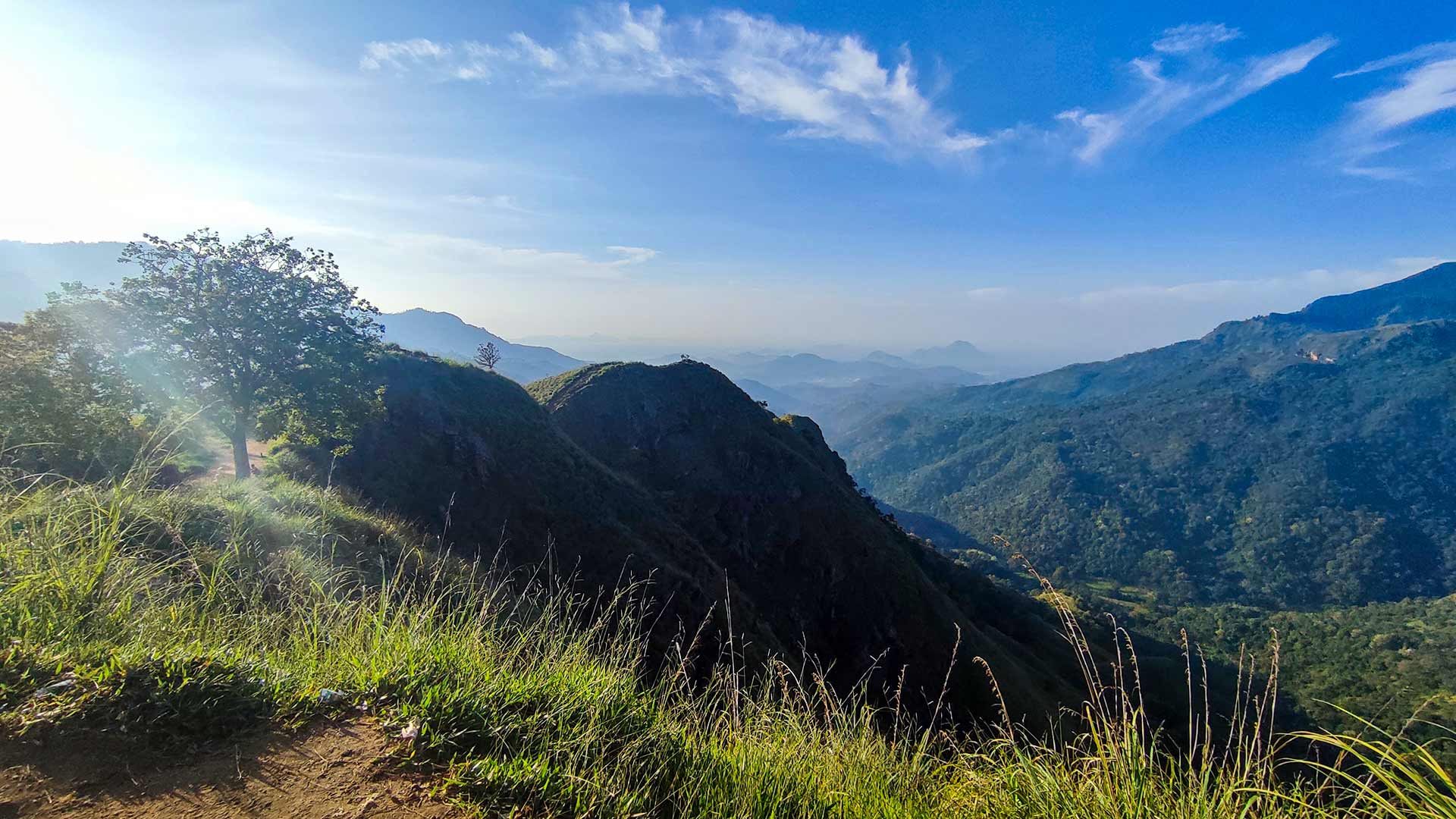
Idalgashinna Mountain is a scenic highland ridge located near Idalgashinna Railway Station, between Haputale and Ohiya in Sri Lanka's central highlands. The area is well known for its breathtaking views, cool climate, and close proximity to one of the most beautiful railway lines in the country.
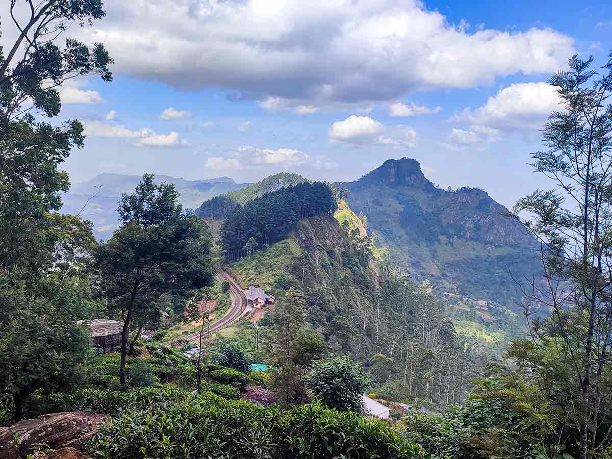
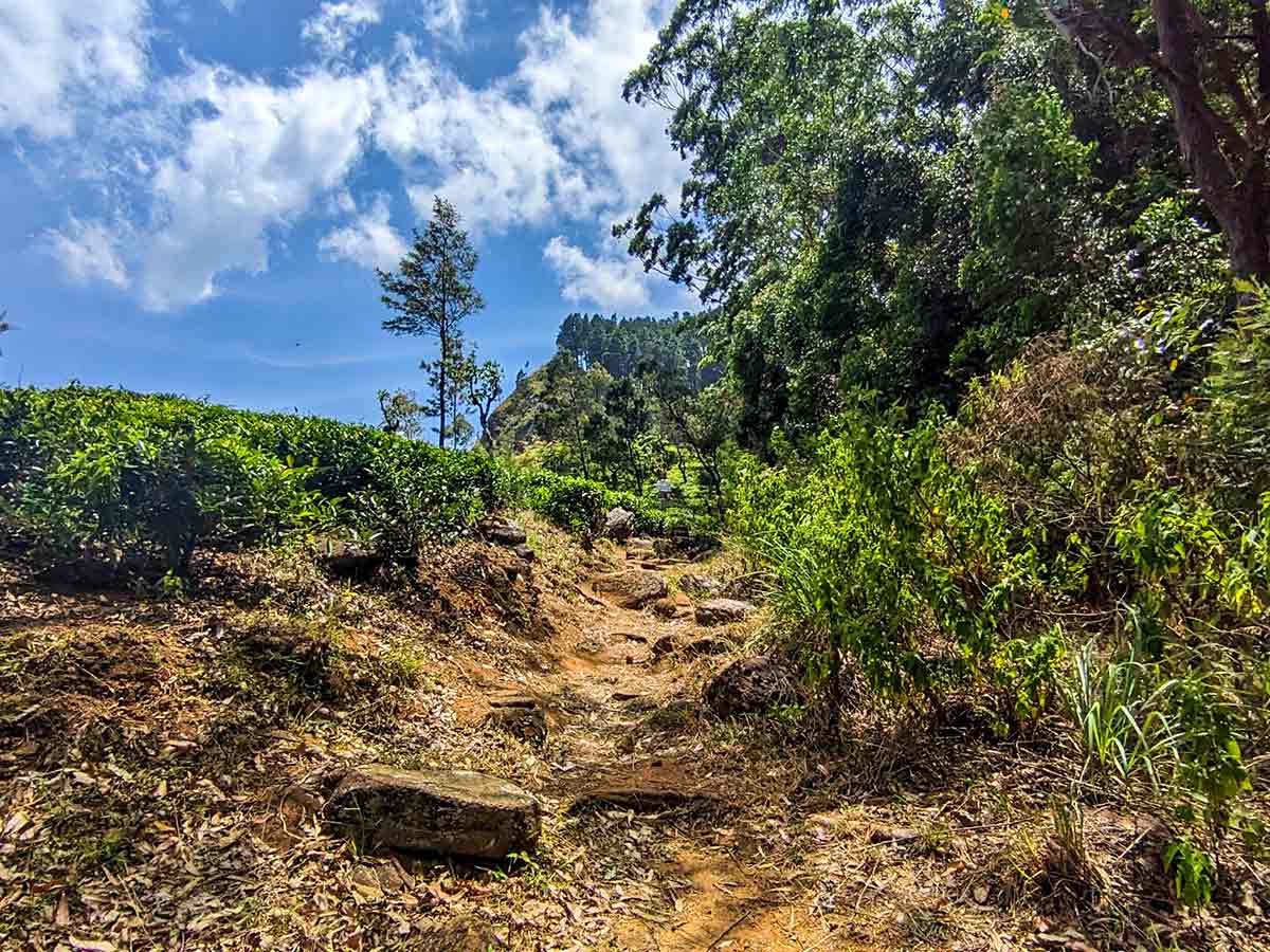
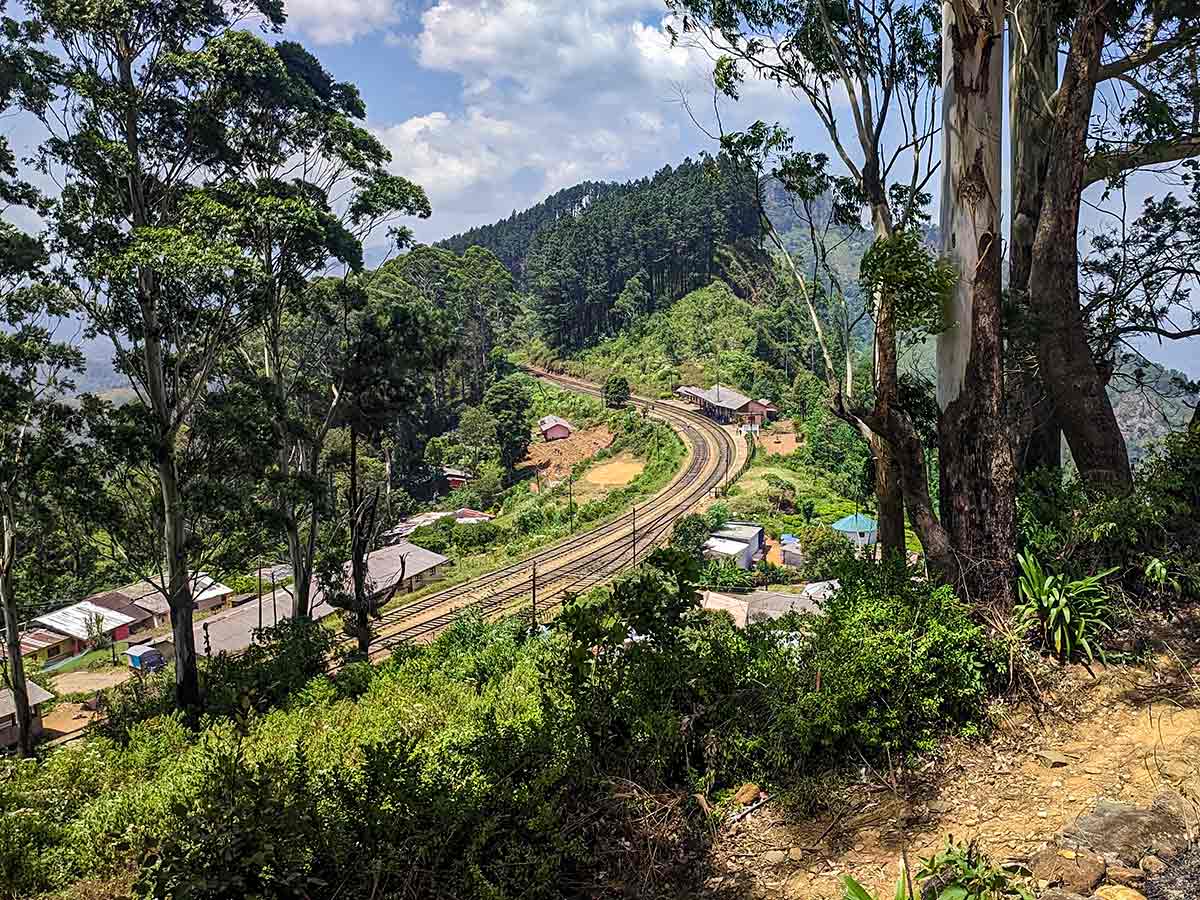
The hike is relatively moderate and follows a mix of railway track sections, estate roads, and grassy ridgelines. One of the most unique aspects of this hike is the ability to walk alongside the famous hill country railway, passing through tunnels and bridges while enjoying uninterrupted views across the surrounding valleys.
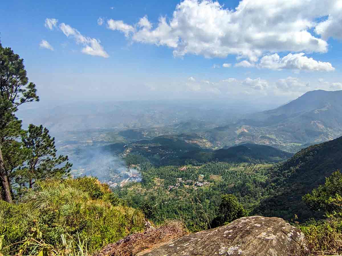
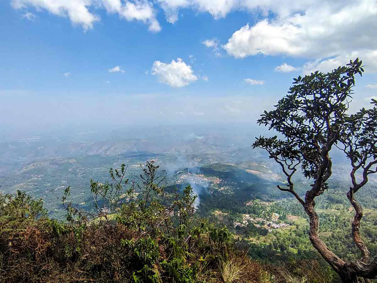
As the trail gains elevation, hikers are rewarded with wide panoramic views of tea plantations, forest patches, and distant mountain ranges. On clear days, the southern plains can be seen stretching far into the distance, while mist often rolls through the hills creating dramatic scenery.
The summit area itself is not a single peak but rather an extended ridge, offering multiple viewpoints along the way. The cool climate and constant wind make the hike comfortable, even during warmer months.
Due to its accessibility from Idalgashinna and Ohiya railway stations, this hike is popular among both local hikers and travelers looking for a less crowded alternative to Ella Rock or Horton Plains.
Gallery
🧭 How to Get There
📍 Location
Haputale area, Badulla District, Uva Province
🚗 How to Reach
- From Colombo (~170 km • ~5:30 h)
🧭 Select your starting point
Click markers to open locations in Google Maps
Travel Tips
- Take the train to Idalgashinna - one of the most scenic rail journeys in Sri Lanka.
- Start early morning for clear views before mist develops.
- Wear comfortable shoes - railway stones and uneven paths can be rough.
- Carry water and snacks as there are no facilities along the trail.
- Use offline maps - some trail sections are not clearly marked.
Safety Notes
Please read before visiting
- Be cautious when walking along railway tracks - stay alert for trains.
- Avoid tunnels unless visibility is clear and safe.
- Weather can change quickly - mist reduces visibility.
- Trail edges along ridges can be steep in some sections.
- Limited mobile signal in remote areas.
Nearby Destinations
 Cultural Site
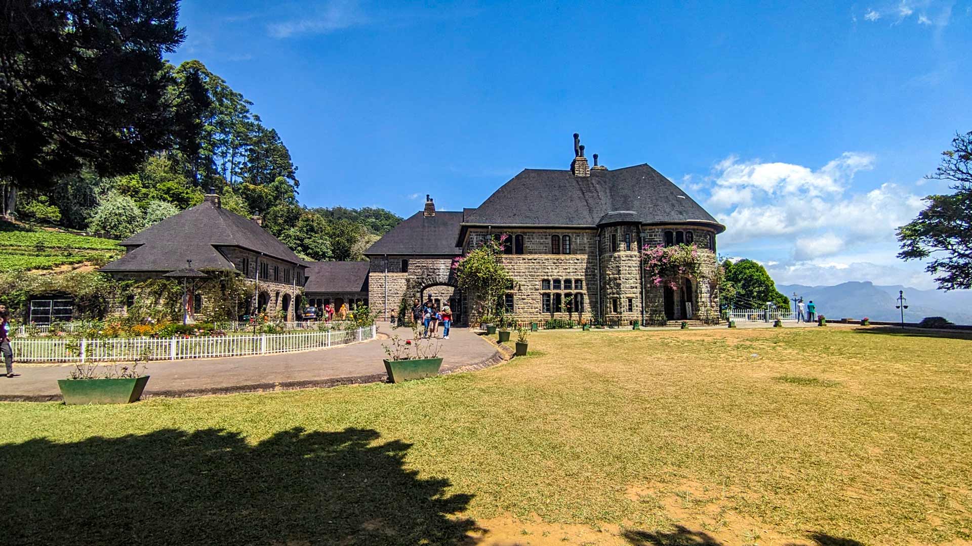
Adisham Bungalow (St. Benedict's Monastery)
Adisham Bungalow is a 1931 Tudor-style country house near Haputale, currently functioning as a Benedictine monastery and open to visitors.
View Details
 Waterfall
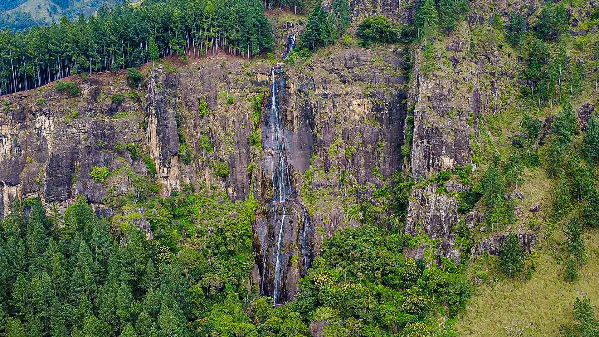
Bambarakanda Waterfall
Bambarakanda Waterfall is the tallest waterfall in Sri Lanka with a 241 m vertical drop, located near Kalupahana in the Badulla District of the central highlands.
View Details
 Waterfall
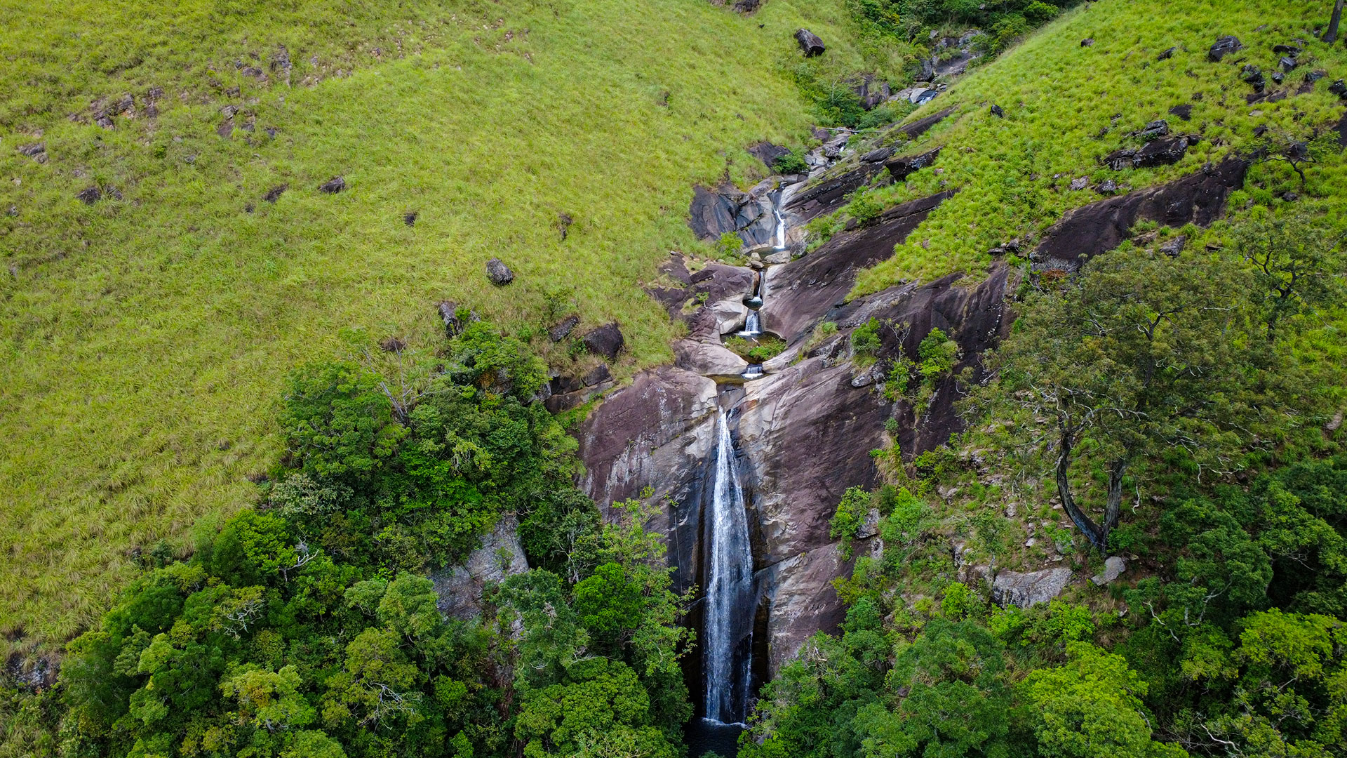
Lanka Ella Waterfall
Lanka Ella Waterfall is a 32 m high waterfall near Walhaputenna in Haldummulla, Badulla District, located 1 km from Bambarakanda Falls and accessible only by forest trekking.
View Details
Explore More Hiking Trails
 Hiking Trail
Ella Rock
Ella Rock is a scenic hiking trail near Ella town, known for its rewarding summit views and varied terrain through railway tracks, tea estates, and forest paths.
View Details
 Hiking Trail
Little Adam's Peak
Little Adam's Peak is a short and accessible hike near Ella town, offering some of the best panoramic views in Sri Lanka with minimal effort.
View Details
 Hiking Trail
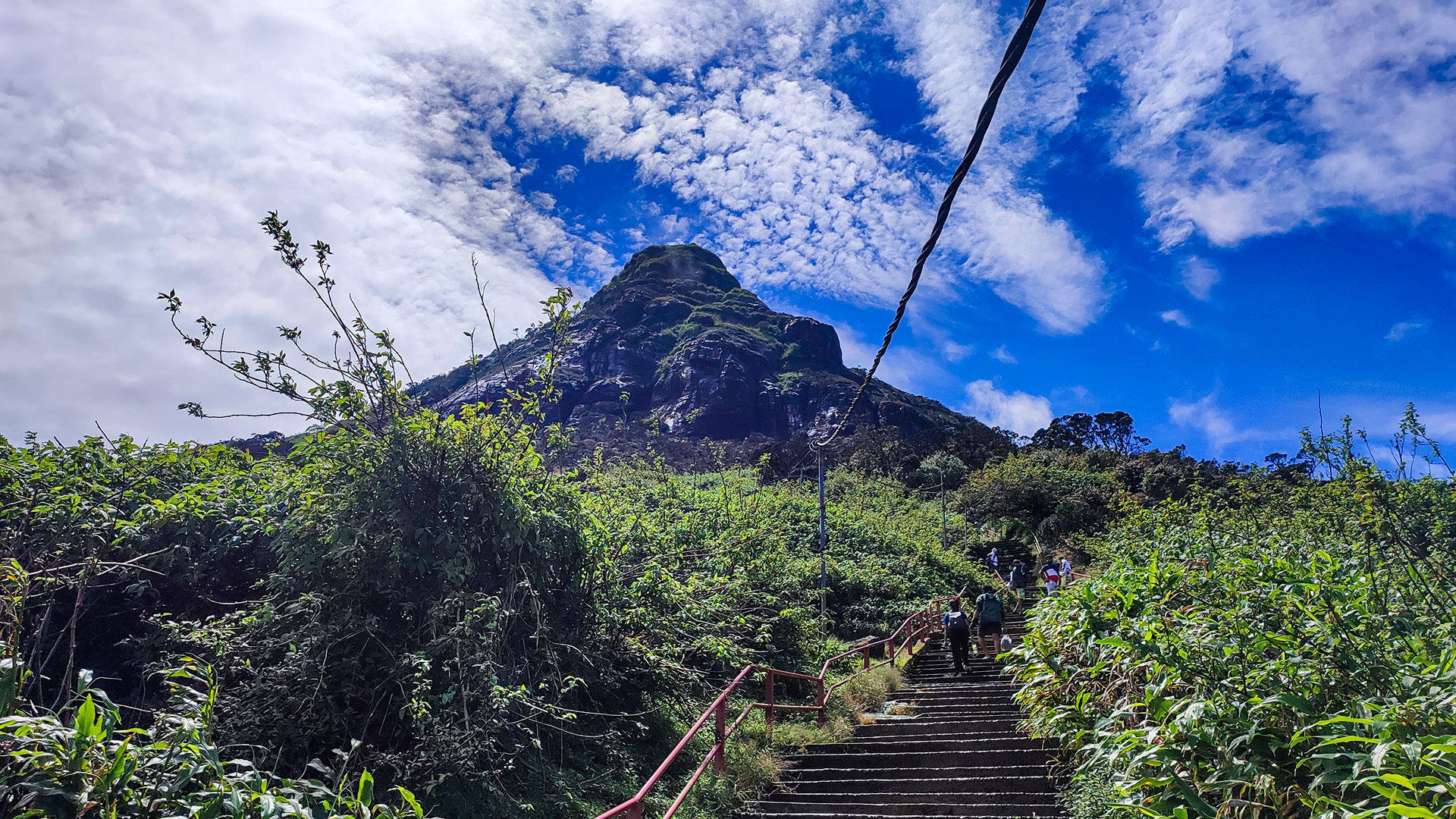
Adam's Peak - Hatton (Nallathanniya) Trail
The Hatton-Nallathanniya trail is the most used route to Adam's Peak (Sri Pada), offering a well-paved 5 km ascent to the summit.
View Details