Horton Plains Trail
A 9.5 km high-altitude circular trail across the Horton Plains plateau, passing World's End cliff, Baker's Falls, and montane cloud forest in one of Sri Lanka's most biodiverse national parks.
Distance
Difficulty
Best Time to Visit
Entrance Fee
Overview
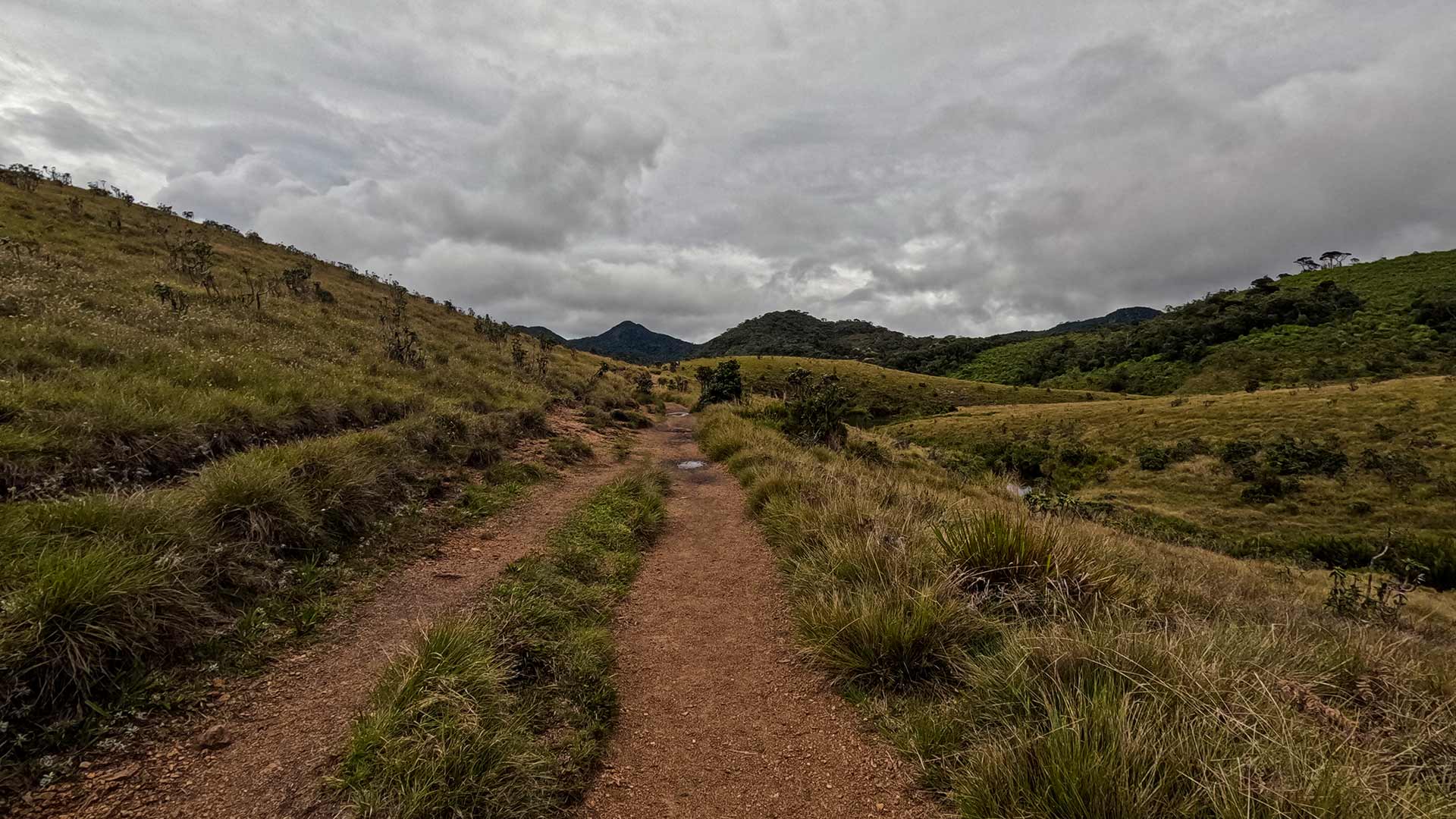
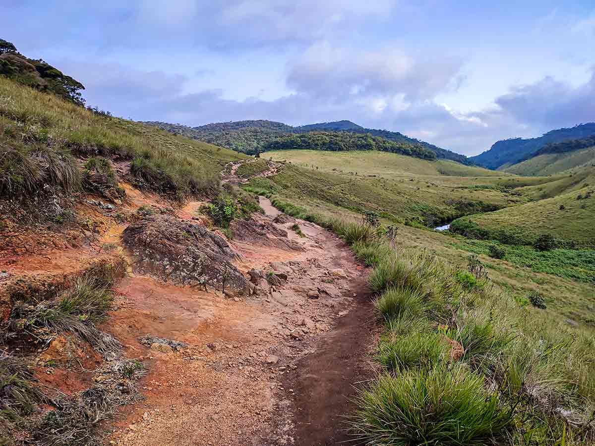
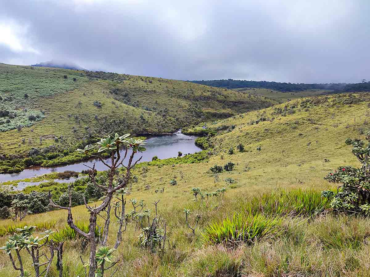
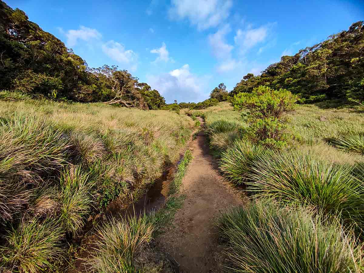
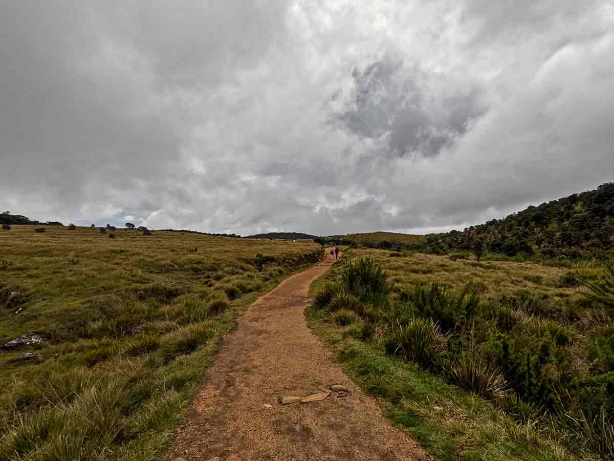
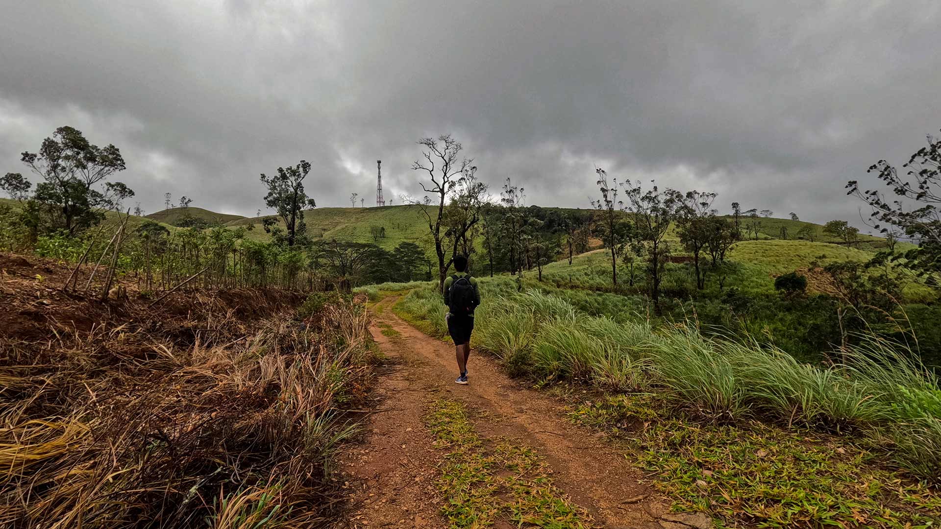
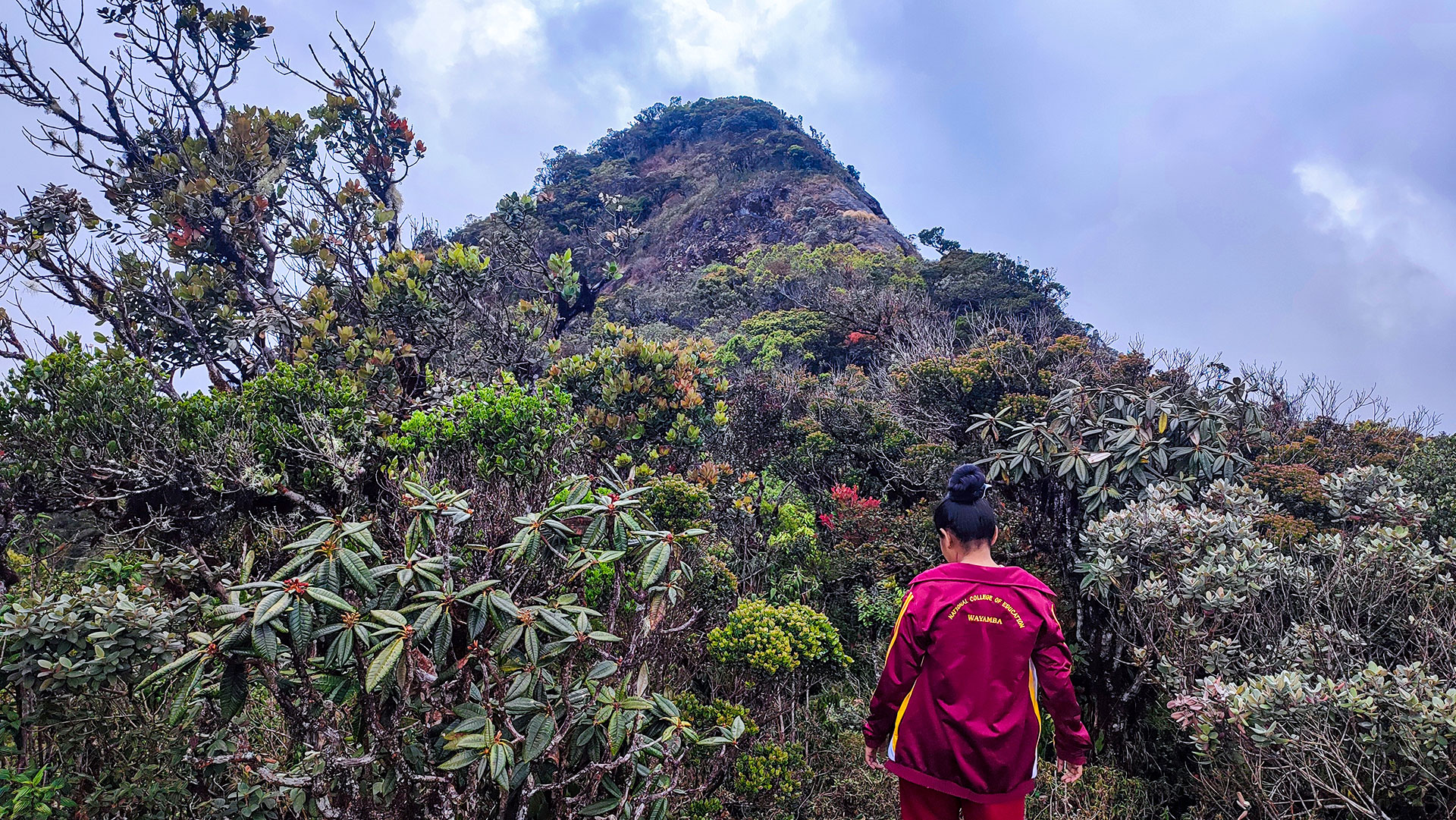
The Horton Plains Trail is Sri Lanka's most iconic high-altitude walk, set within Horton Plains National Park at elevations between 2,100 and 2,300 metres. This 9.5 km circular route crosses a unique landscape of patana grasslands and montane cloud forest, home to a rich collection of endemic wildlife and plant species.
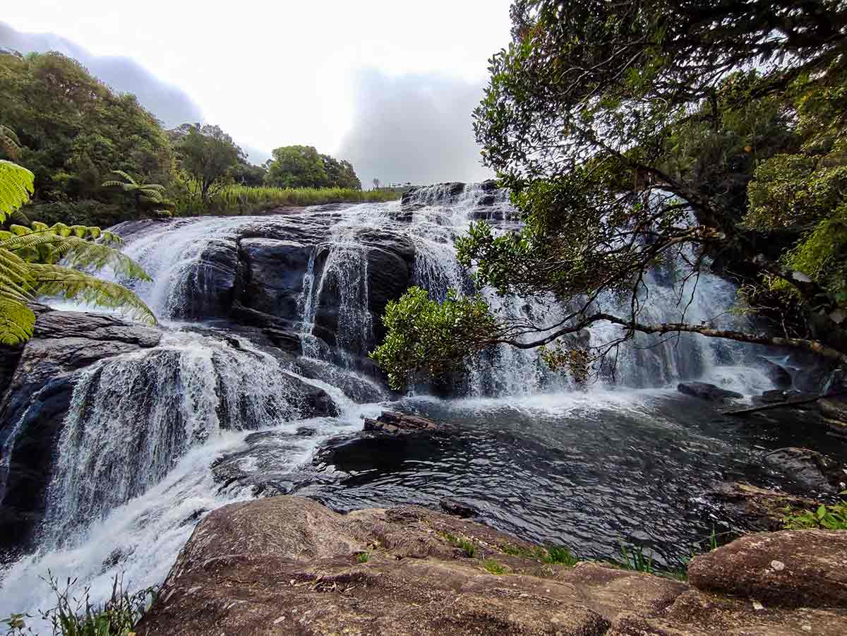
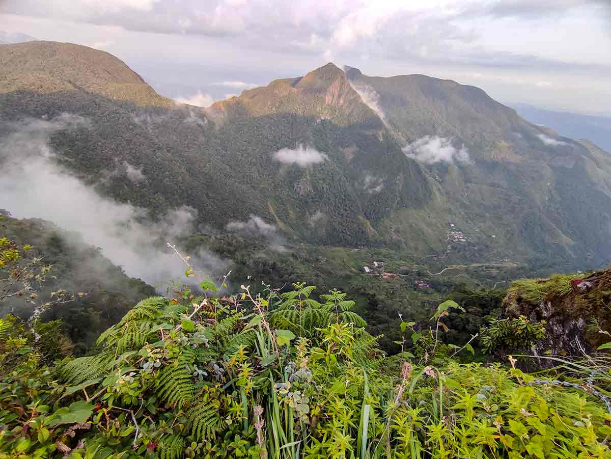
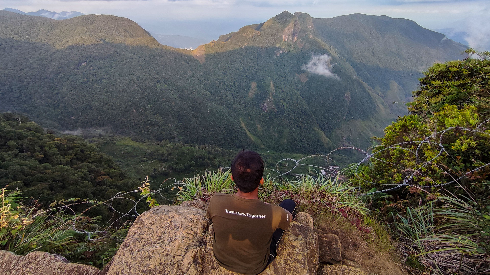
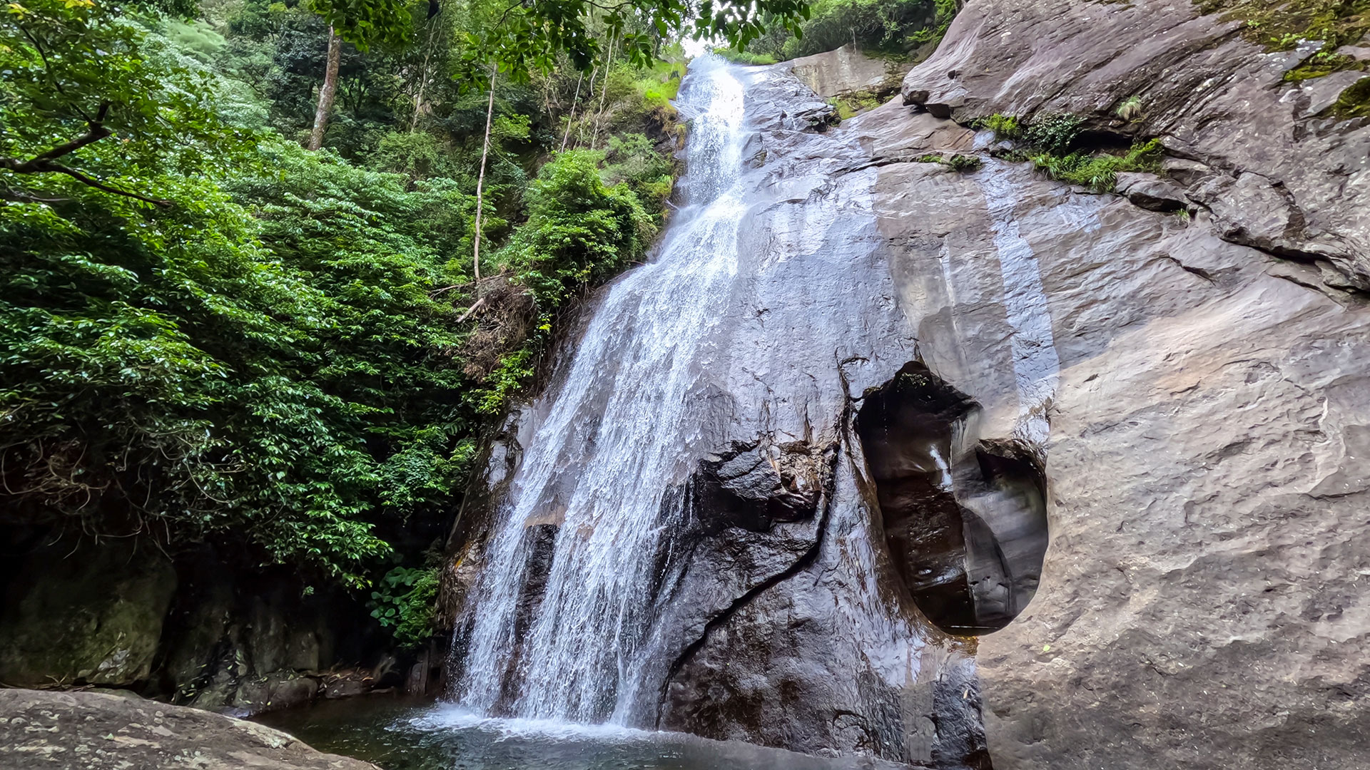
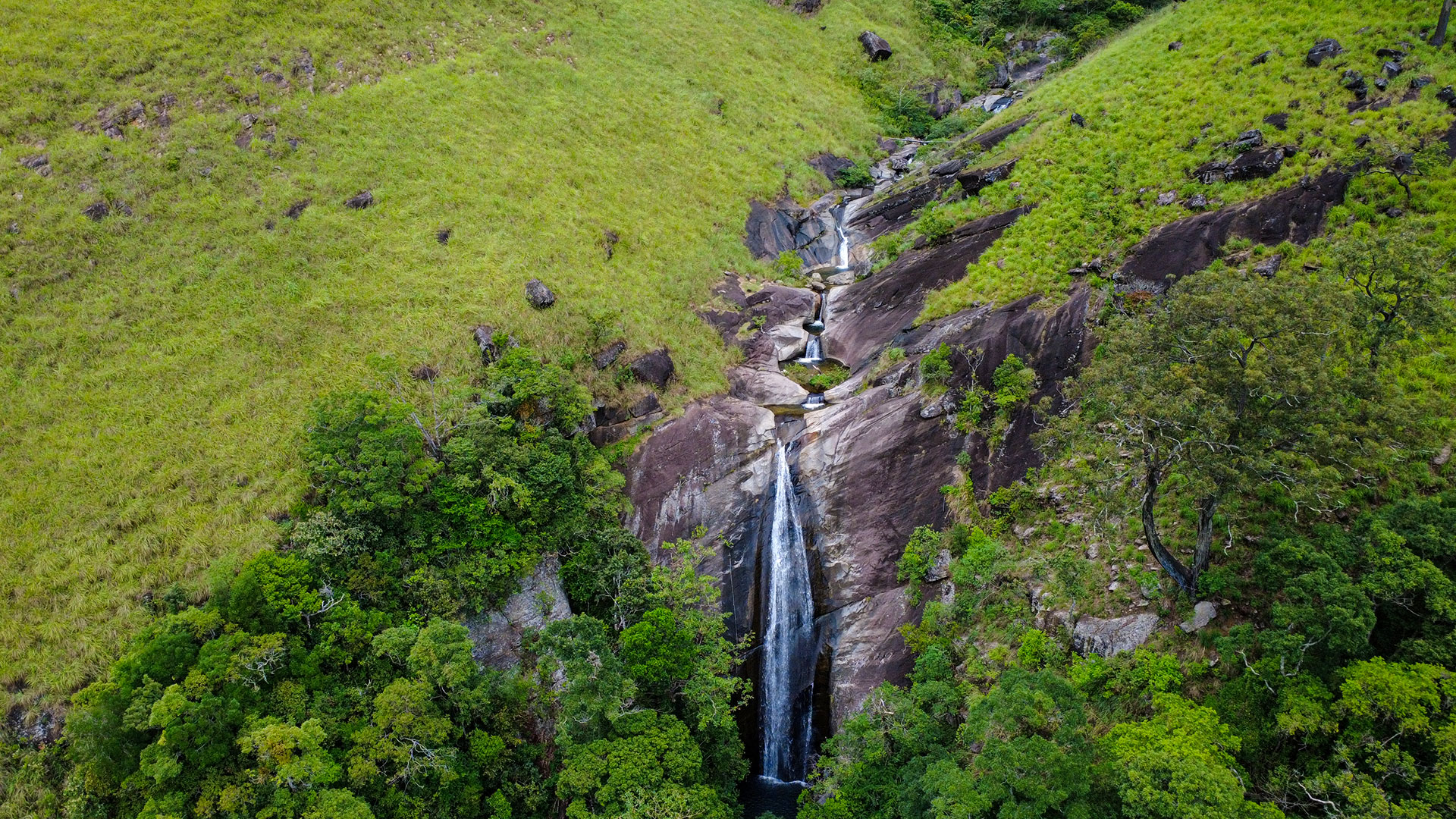
The highlight of the trail is World's End - a dramatic escarpment with a drop of around 1,200 metres (4,000 ft), offering breathtaking views across the southern lowlands on clear mornings. The route also leads to Baker's Falls, a 20-metre waterfall hidden within a cool, forested section fed by the Belihul Oya river.
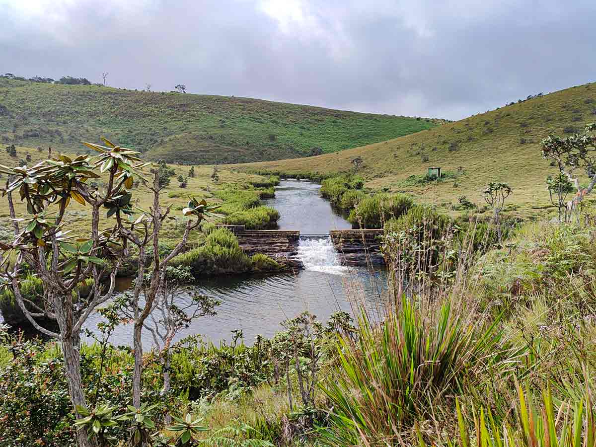
Horton Plains is one of Sri Lanka's most important watershed regions, forming the source of major rivers including the Mahaweli, Kelani, and Walawe. The plateau is often covered in mist, with cool temperatures and occasional ground frost adding to its unique highland atmosphere.
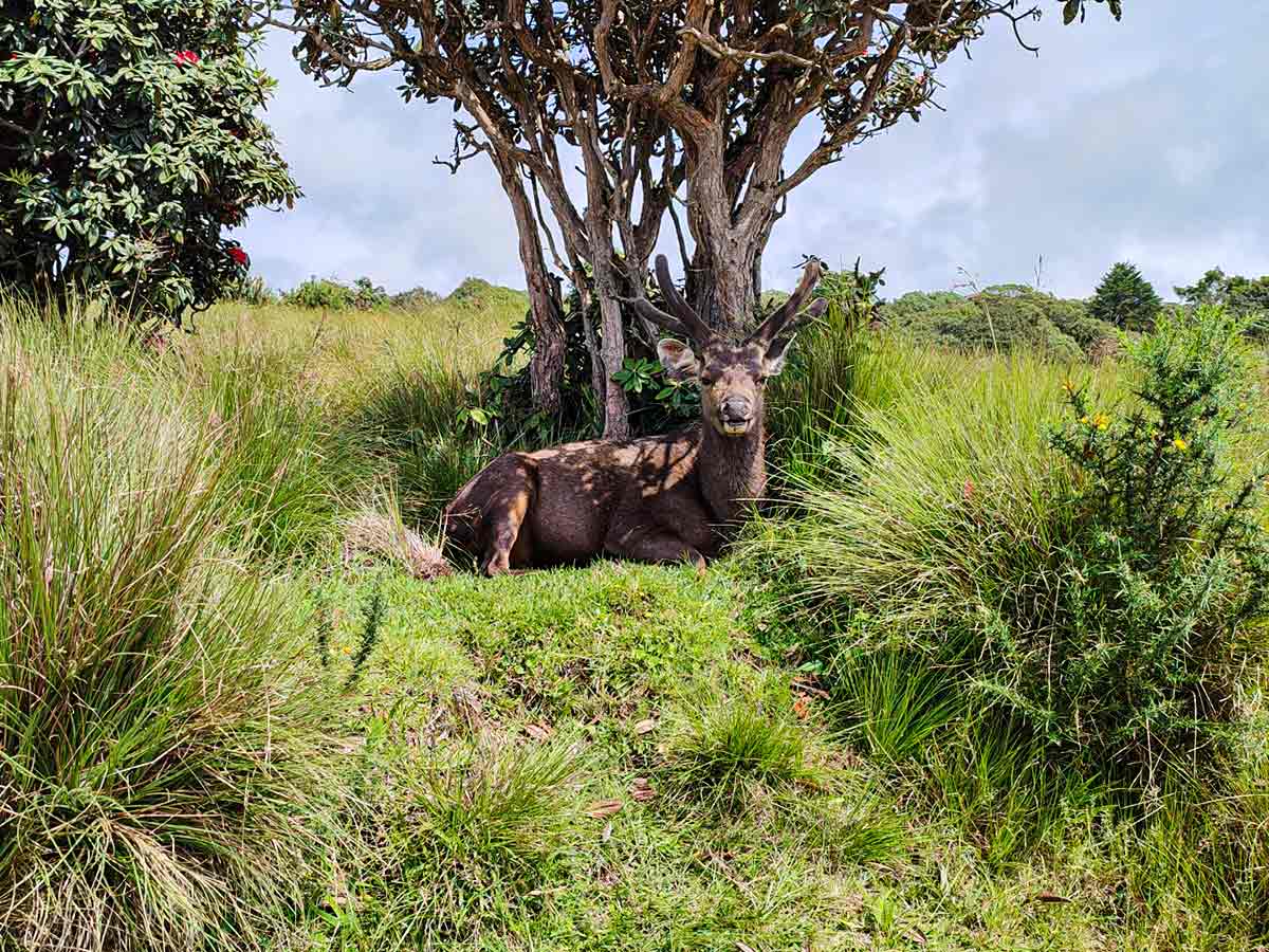
Wildlife such as sambar deer and endemic bird species are commonly seen along the trail, making it both a scenic and ecological highlight. Best explored early in the morning, the Horton Plains Trail offers a rare combination of dramatic views, biodiversity, and accessible hiking in the heart of Sri Lanka's central highlands.
Gallery
🧭 How to Get There
📍 Location
Horton Plains National Park, Nuwara Eliya District, Central Province
🚗 How to Reach
- From Colombo (~181 km • ~6 h)
🧭 Select your starting point
Click markers to open locations in Google Maps
Travel Tips
- Arrive at the park gate as early as possible (6:00 AM opening) to reach World's End before mist arrives.
- Bring warm clothing - temperatures at 2,100 m can be 8-12°C in the morning even in April.
- Carry water and snacks - the small food stall near Baker's Falls is the only facility on the trail.
- Visit on weekdays in low season to avoid the large crowds that arrive on Sri Lankan public holidays.
- The trail is approximately 3-4 hours at a relaxed pace with photo stops.
- Photography from World's End is best between 6:30 and 8:30 AM on dry-season mornings.
Safety Notes
Please read before visiting
- Stay on the marked trail - the escarpment edge at World's End has no safety barriers.
- Do not approach the cliff edge beyond the viewing platform.
- Weather can change rapidly - mist and rain arrive quickly from the south.
- Sambar deer on the trail may seem tame but are wild animals - do not feed or approach them.
- The park closes at 6:00 PM - ensure you complete the trail well before dusk.
Nearby Destinations
 Viewpoint
The Great World's End - Horton Plains
The Great World's End is a sheer escarpment inside Horton Plains National Park, offering one of the most breathtaking panoramic views in Sri Lanka.
View Details
 Waterfall
Yahalathenna Waterfall
Yahalathenna Waterfall (also spelled Yahalatenna or Yahala Thenna) is a 90 ft high waterfall near Walhaputenna in Haldummulla, offering a quiet alternative to Bambarakanda.
View Details
 Waterfall
Lanka Ella Waterfall
Lanka Ella Waterfall is a 32 m high waterfall near Walhaputenna in Haldummulla, Badulla District, located 1 km from Bambarakanda Falls and accessible only by forest trekking.
View Details
Explore More Trails
 Trail
TrailPekoe Trail
The Pekoe Trail is a 323 km long-distance walking trail across 22 stages through Sri Lanka's central highlands, connecting Kandy, Hatton, Haputale, Ella, and Nuwara Eliya.
View Details
ViewpointThe Great World's End - Horton Plains
The Great World's End is a sheer escarpment inside Horton Plains National Park, offering one of the most breathtaking panoramic views in Sri Lanka.
View Details
 Hiking Trail
Kirigalpoththa
Kirigalpoththa is Sri Lanka's second highest mountain and the tallest peak open to public access, located in Horton Plains National Park.
View Details