Diyakerella Waterfall
A 45 m jungle waterfall in Meemure, surrounded by the Knuckles mountain range and accessible via a 12 km forest trek.
Distance
Difficulty
Best Time to Visit
Entrance Fee
Overview
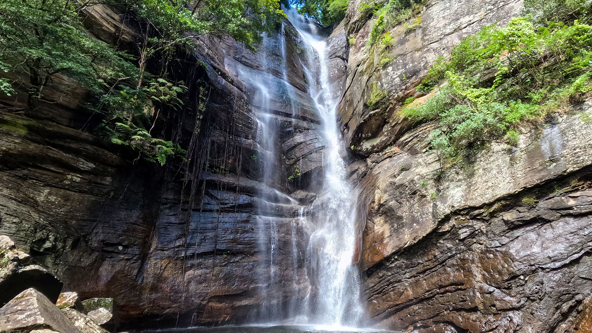
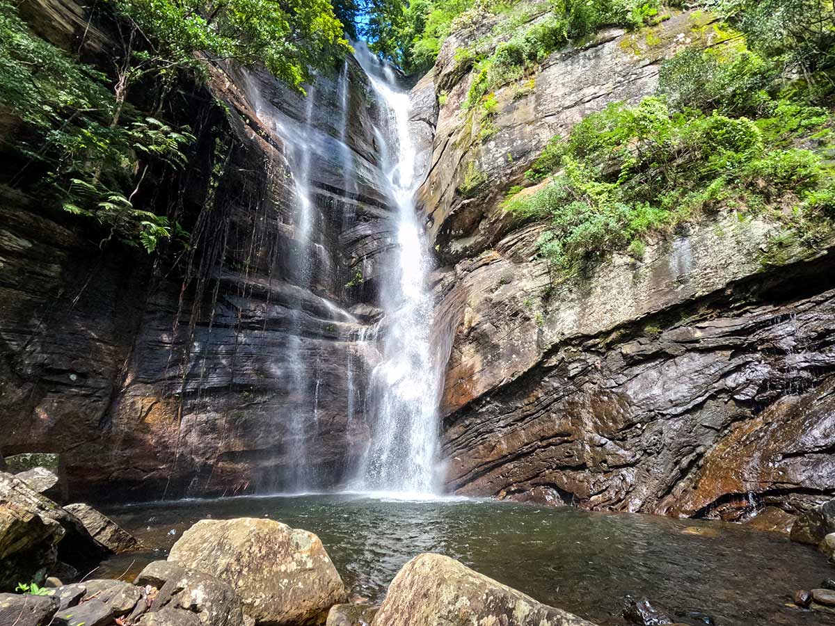
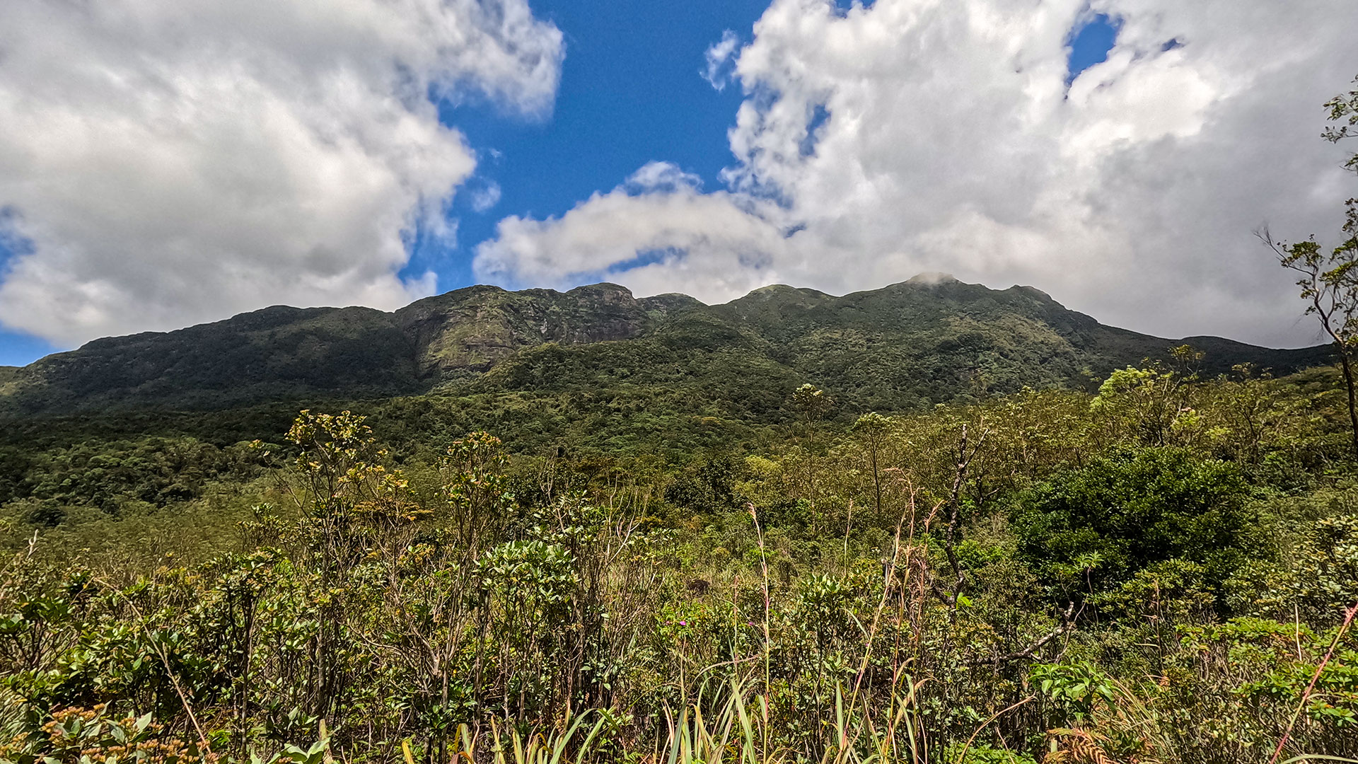
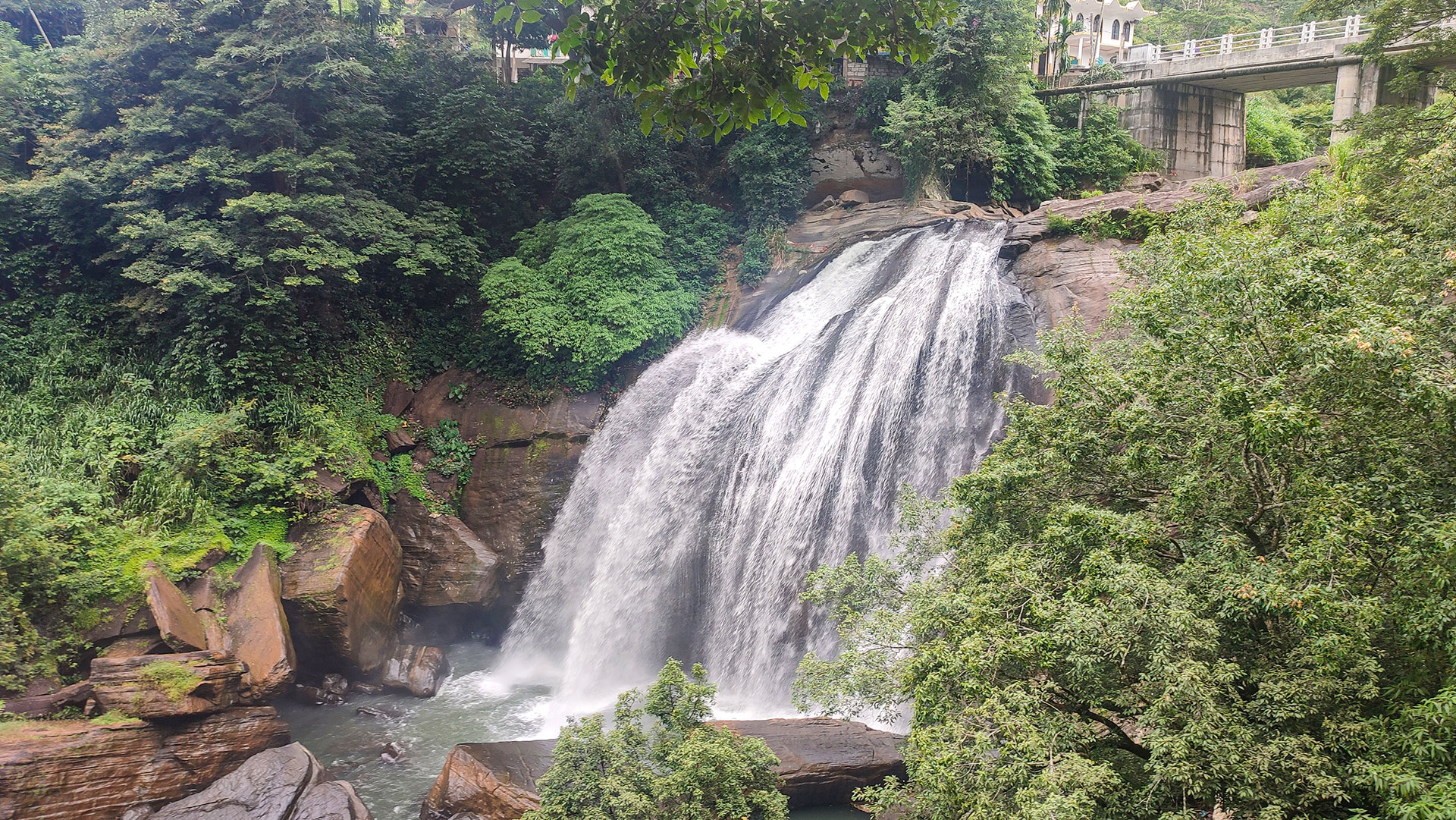
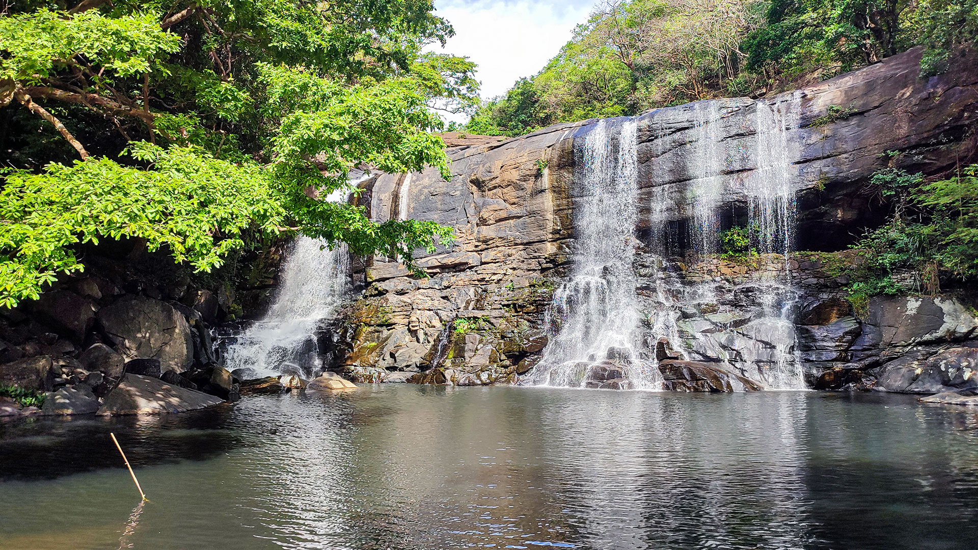
Diyakerella Waterfall is a 45-metre (148 ft) high waterfall located in Meemure village within the Kandy District (Minipe Divisional Secretariat Division). Hidden deep within the Knuckles mountain range, the waterfall flows through dense jungle before cascading down a towering rock formation with an impressive roaring sound.
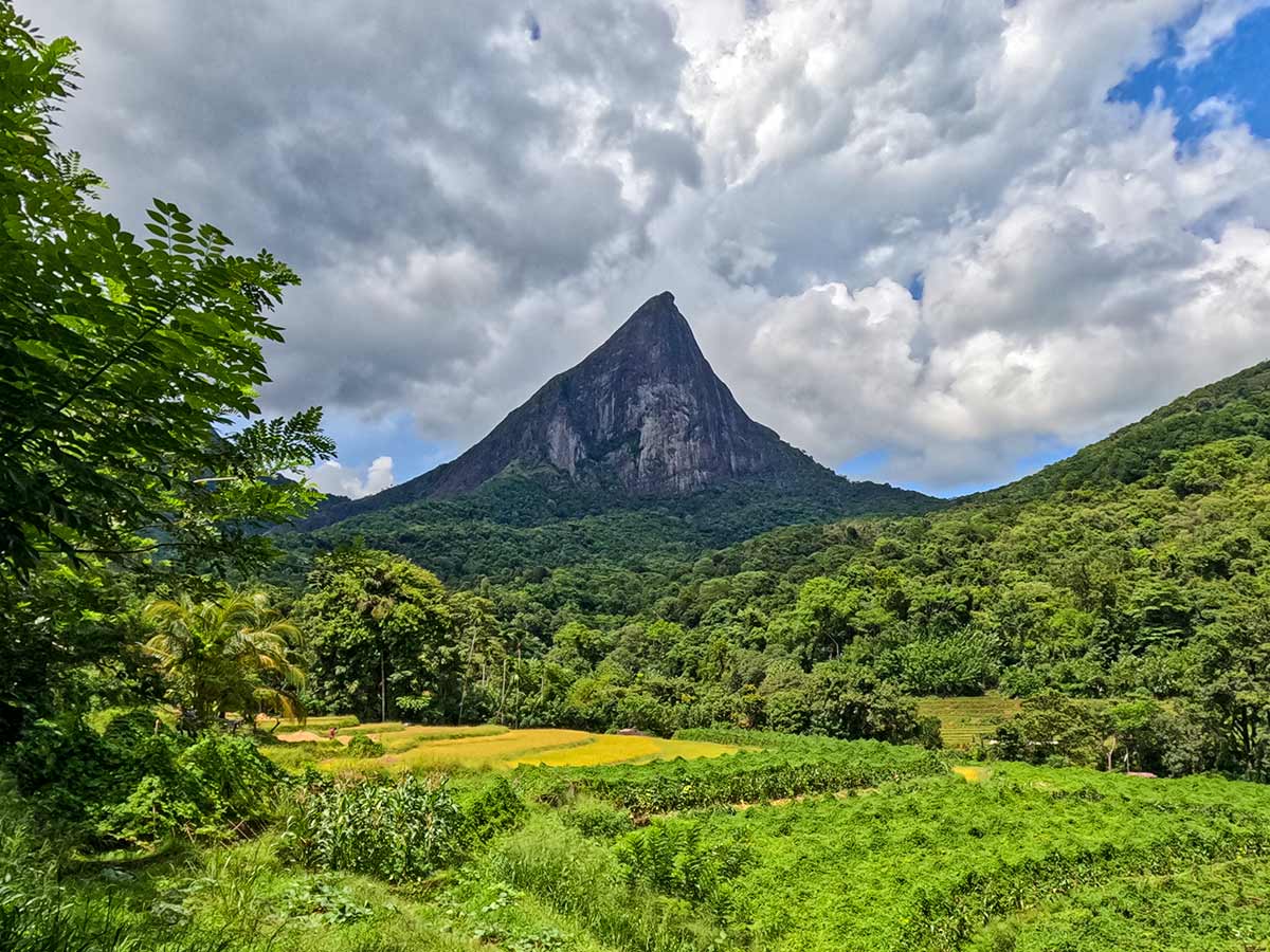
As the water strikes the base, a secondary cascade forms below, although only the upper section is clearly visible through thick forest foliage. The dramatic setting is enhanced by the towering presence of Laggala Mountain near Meemure village, creating one of the most scenic jungle waterfall environments in Sri Lanka.
Beneath the waterfall lies an elephant corridor locally known as -Ethpara.- The surrounding area also includes a nearby monastery, adding cultural interest to the natural landscape. The stream from Diyakerella joins the Heenganga River and eventually flows into the Mahaweli River.
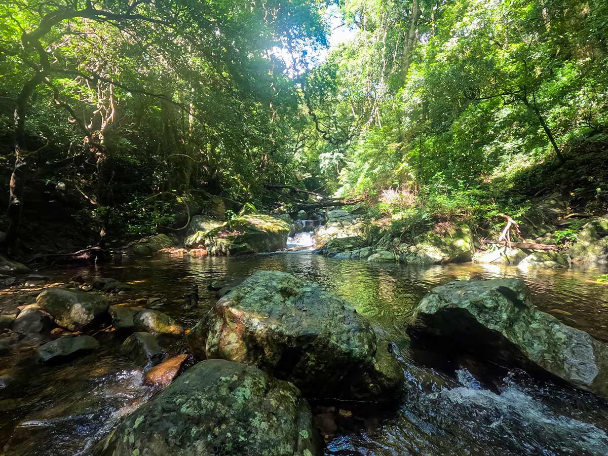
Reaching the waterfall requires an approximately 12 km trek through forest terrain from Meemure village. Due to unmarked paths and dense jungle sections, hiring a local guide is strongly recommended.
Experience
Gallery
🧭 How to Get There
📍 Location
Meemure, Kandy District, Central Province
🚗 How to Reach
- From Colombo (~195 km • ~6:15 h)
🧭 Select your starting point
Click markers to open locations in Google Maps
Travel Tips
- Hire a local guide in Meemure - forest paths are not clearly marked.
- Start the trek early in the morning to allow sufficient return time.
- Wear proper hiking boots suitable for jungle terrain.
- Carry enough drinking water and snacks - no shops along the trekking route.
- Be aware of elephant movement in the "Ethpara" corridor.
- Respect the nearby monastery and local village customs.
Safety Notes
Please read before visiting
- The 12 km trek can be physically demanding; assess your fitness level.
- Avoid trekking during heavy rainfall - jungle paths become slippery.
- Wildlife including elephants may pass through the area.
- Mobile network coverage is very limited.
- Do not attempt the trek alone without informing locals.
Nearby Destinations
 Hiking Trail
Knuckles 05 Peak - Bambarella Trail
The Bambarella Trail, also known as Dawatagala Knuckles Natural Trail, is a moderate hike in the Knuckles Conservation Forest leading to the 05 Peak ridge.
View Details
 Waterfall
Huluganga Waterfall
Huluganga Waterfall (Huluganga Ella) is a 75 m high cascade in Kandy District, originating from the Knuckles mountain range and flowing toward Victoria Reservoir.
View Details
 Viewpoint
Kalabokka 360 Upper Division Viewpoint
Kalabokka 360 Upper Division Viewpoint is a high-altitude lookout in the Knuckles Conservation Forest, renowned for its all-round views over steep valleys, village settlements, and rolling highland terrain.
View Details
Explore More Waterfalls
WaterfallHuluganga Waterfall
Huluganga Waterfall (Huluganga Ella) is a 75 m high cascade in Kandy District, originating from the Knuckles mountain range and flowing toward Victoria Reservoir.
View Details
 Waterfall
Bambarakiri Ella Waterfall
Bambarakiri Ella Waterfall is a picturesque 3 m cascade in Matale District, set within the Knuckles mountain range and famous for its hanging bridge.
View Details
 Waterfall
Sera Ella Waterfall
Sera Ella Waterfall is a 10 m high twin waterfall located near Illukkumbura in Matale District, known for its accessible cave behind the cascade.
View Details