Knuckles 05 Peak - Bambarella Trail
A moderate mountain trek in the Knuckles Conservation Forest leading across five peaks with panoramic 360° summit views.
Distance
Difficulty
Best Time to Visit
Entrance Fee
Overview
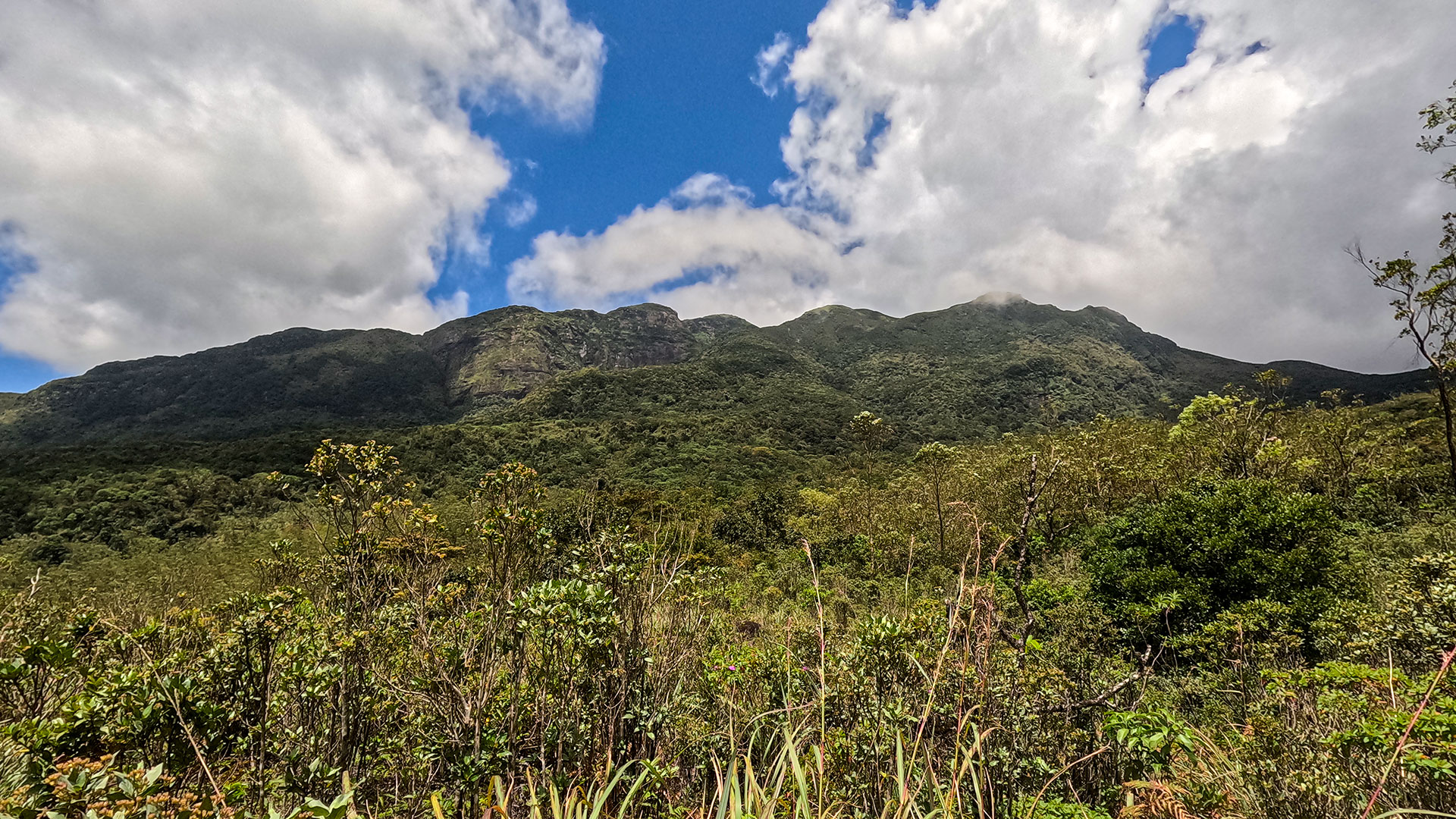
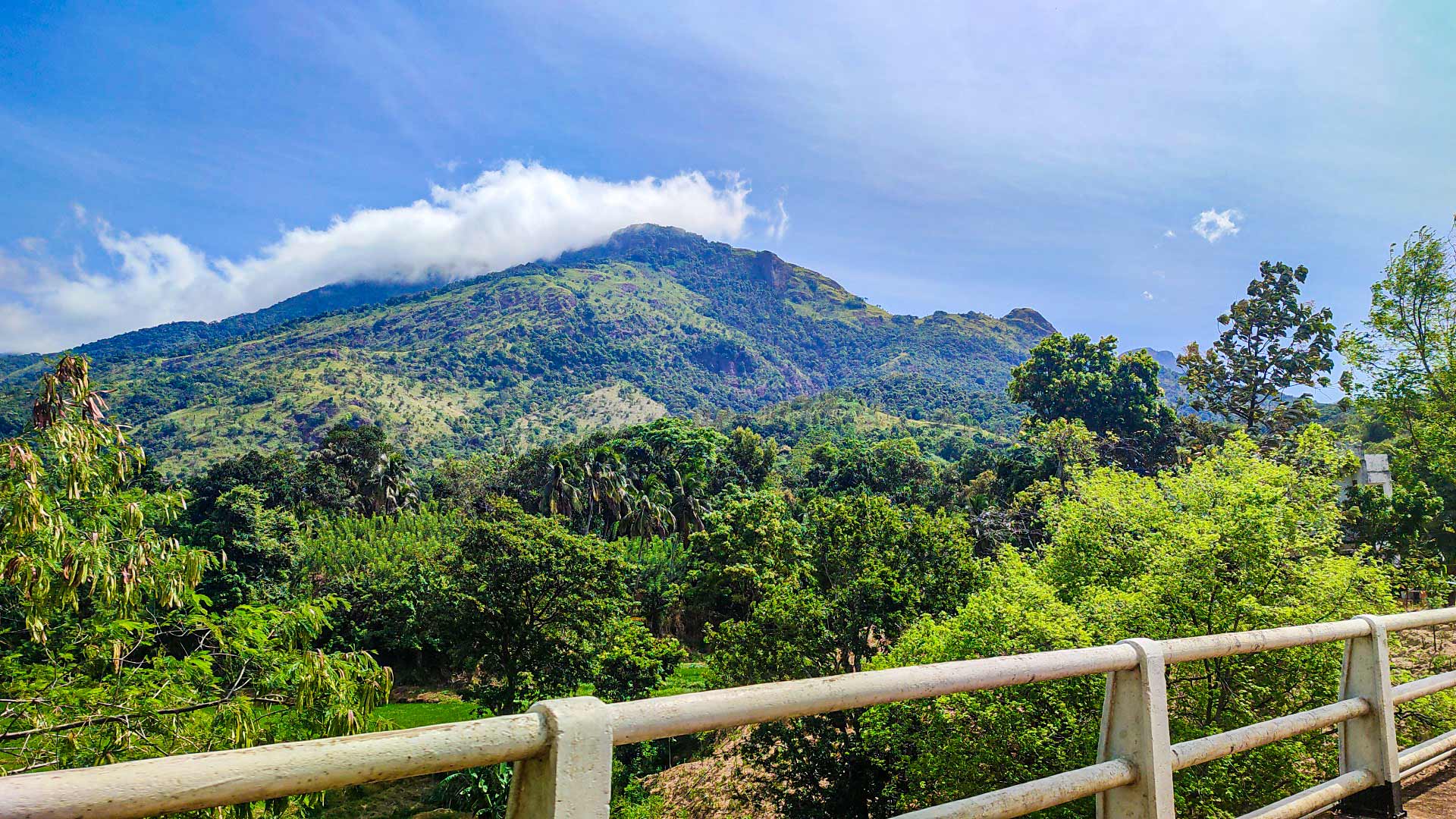
The Knuckles 05 Peak - Bambarella Trail, also known as the Dawatagala Knuckles Natural Trail, is one of the most scenic treks within the Knuckles Conservation Forest.
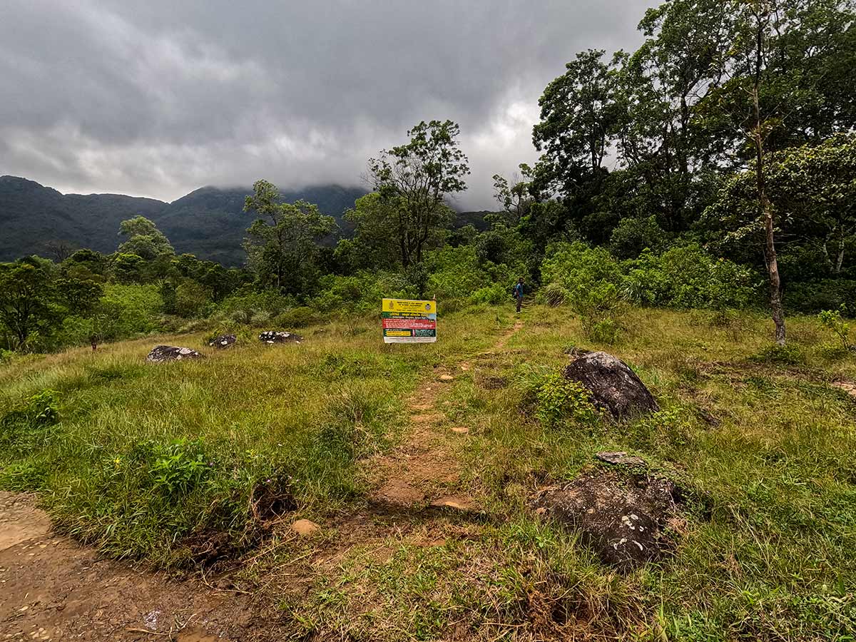
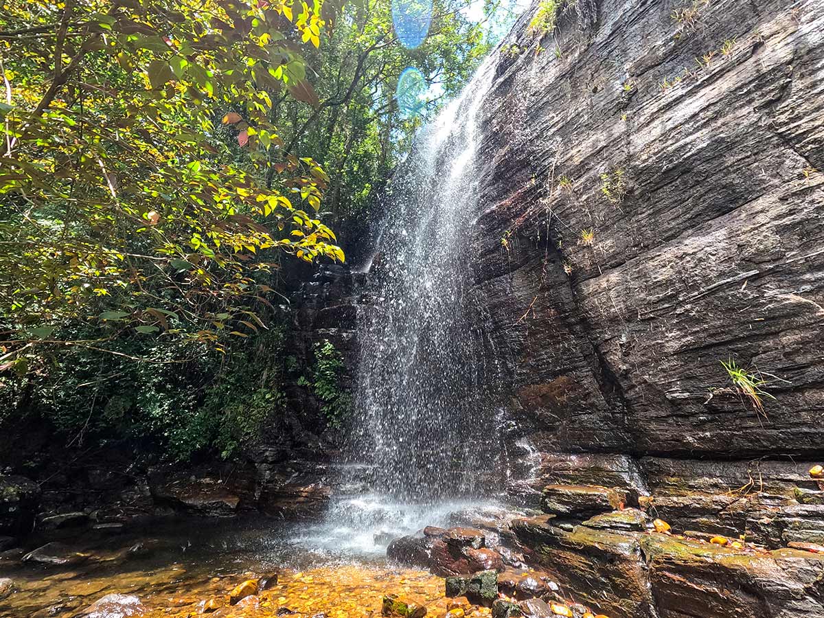
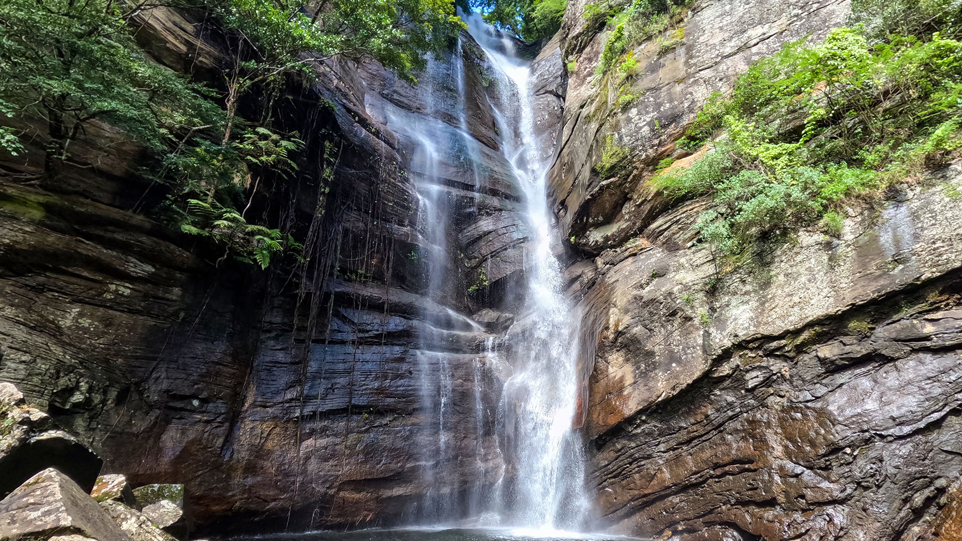
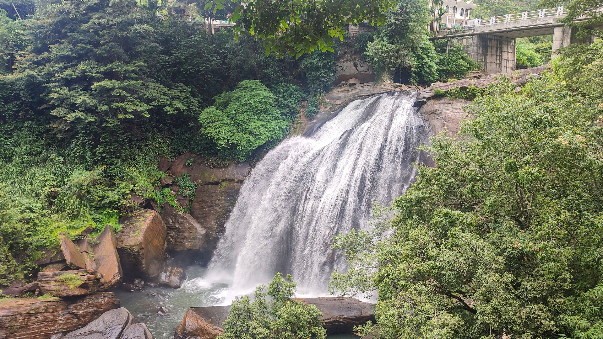
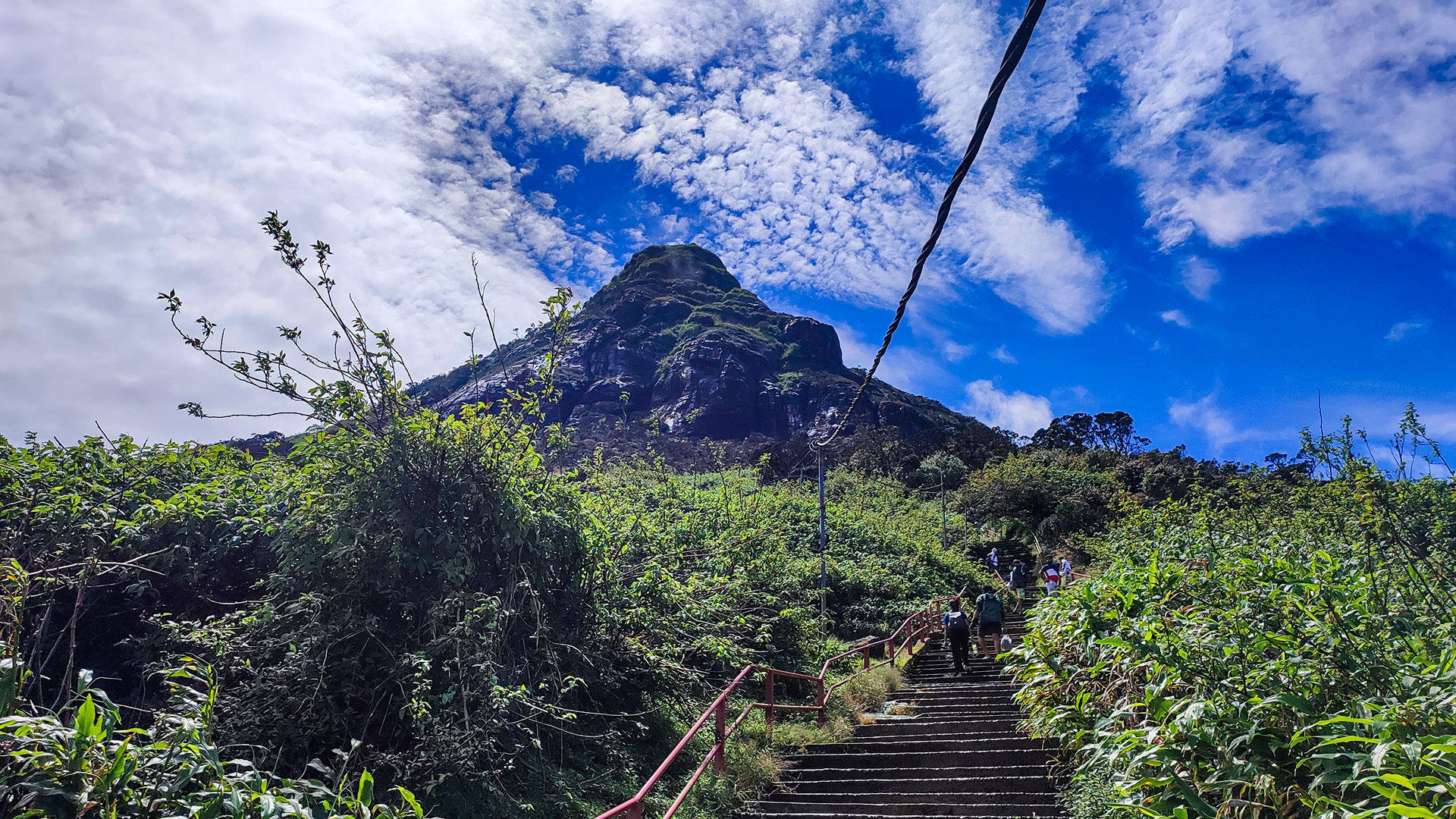
The trail begins near Gomara, where a ticket counter is located. The initial section follows a flat path for about 600 metres before reaching a junction. A short detour leads to Knuckles Falls, the first and last reliable water source on the trail.
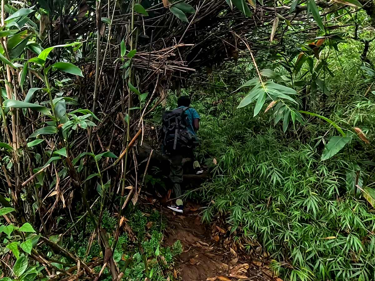
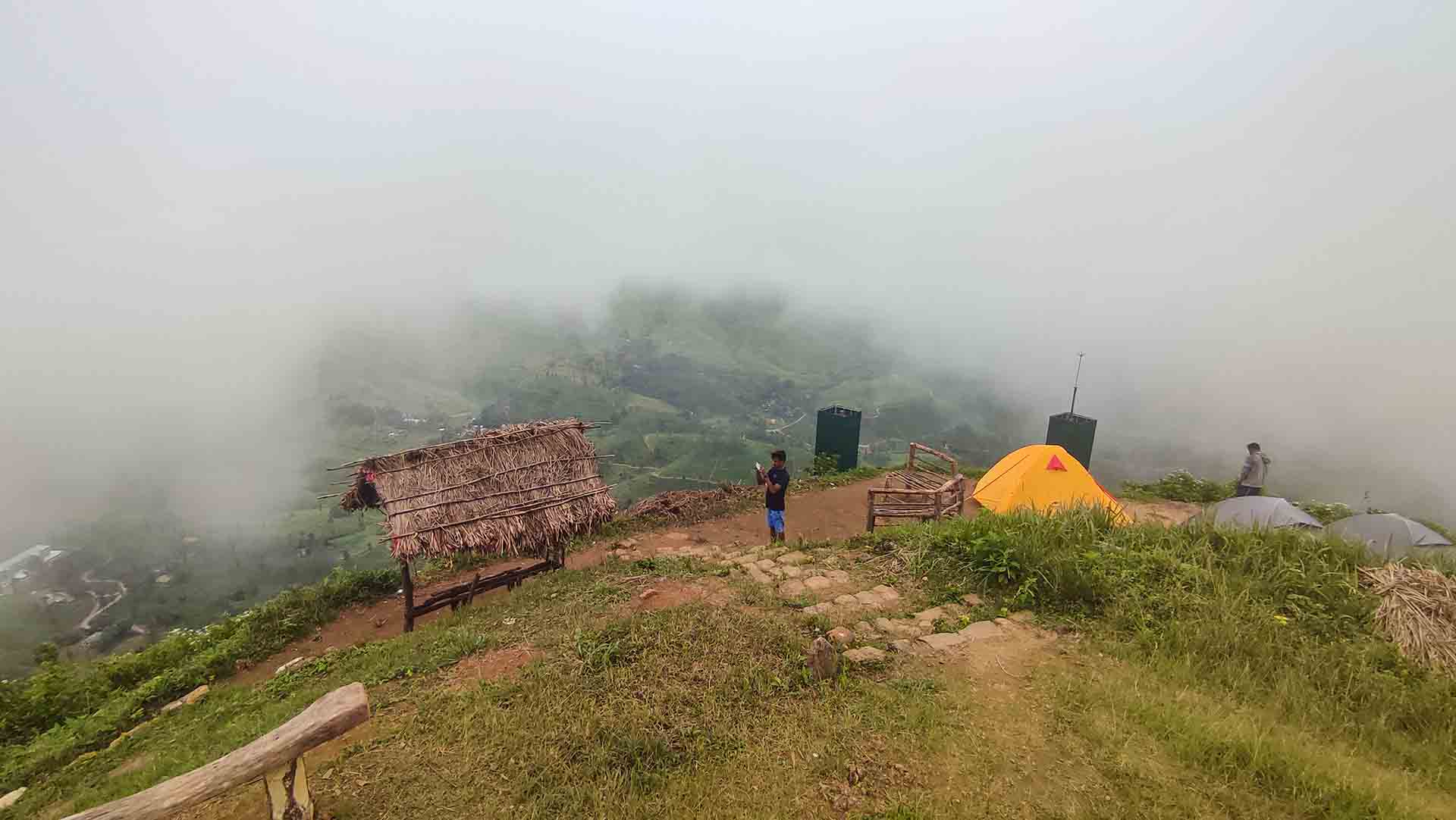
Beyond this point, the trail gradually gains elevation through low-level vegetation and forest terrain, passing two campsite areas before entering dense montane forest. The ascent becomes steeper with loose soil and rocks, requiring careful footing.
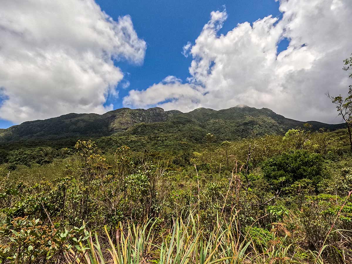
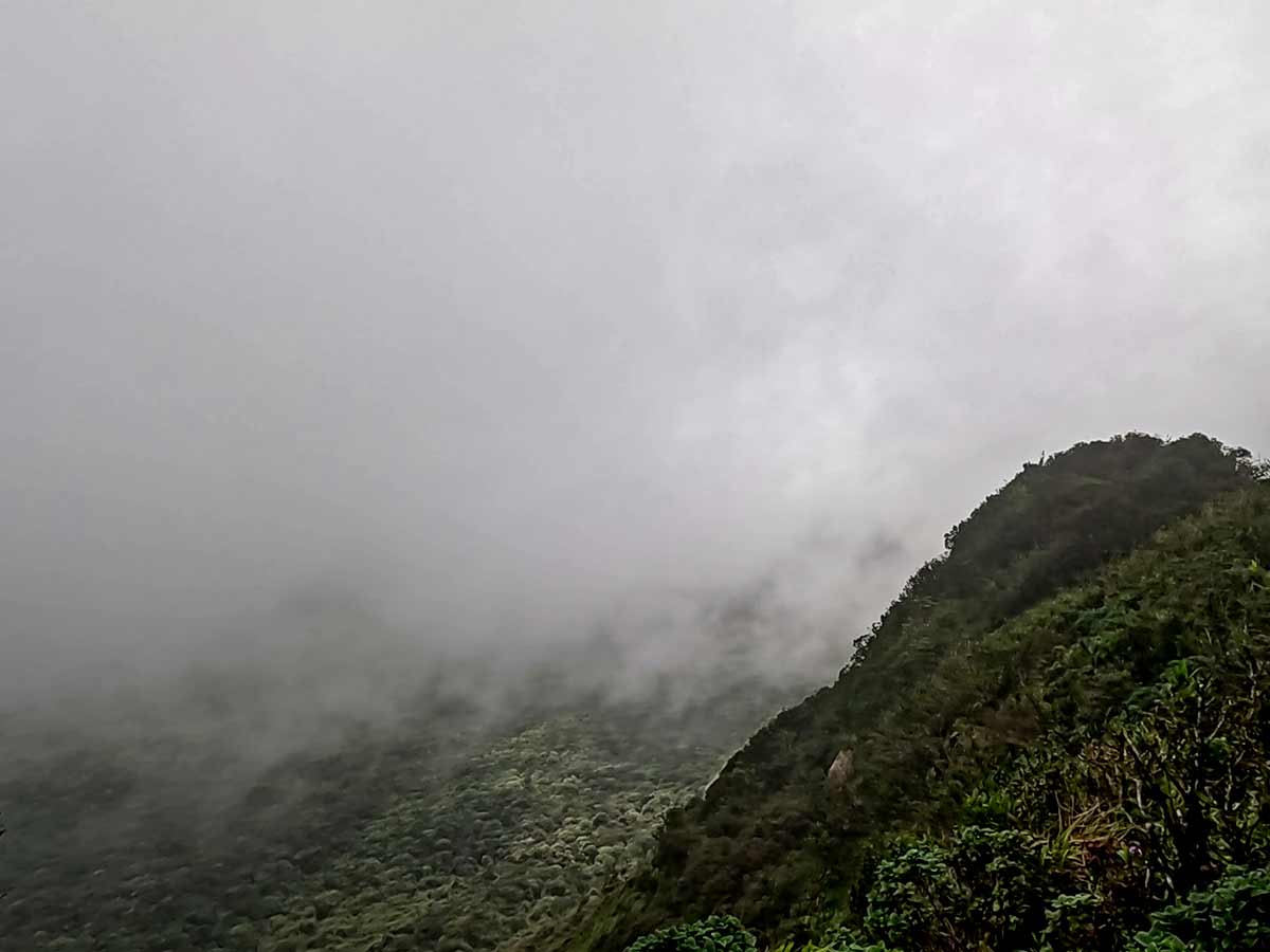
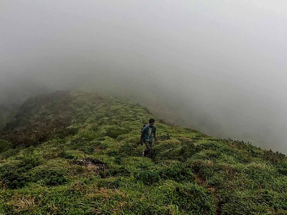
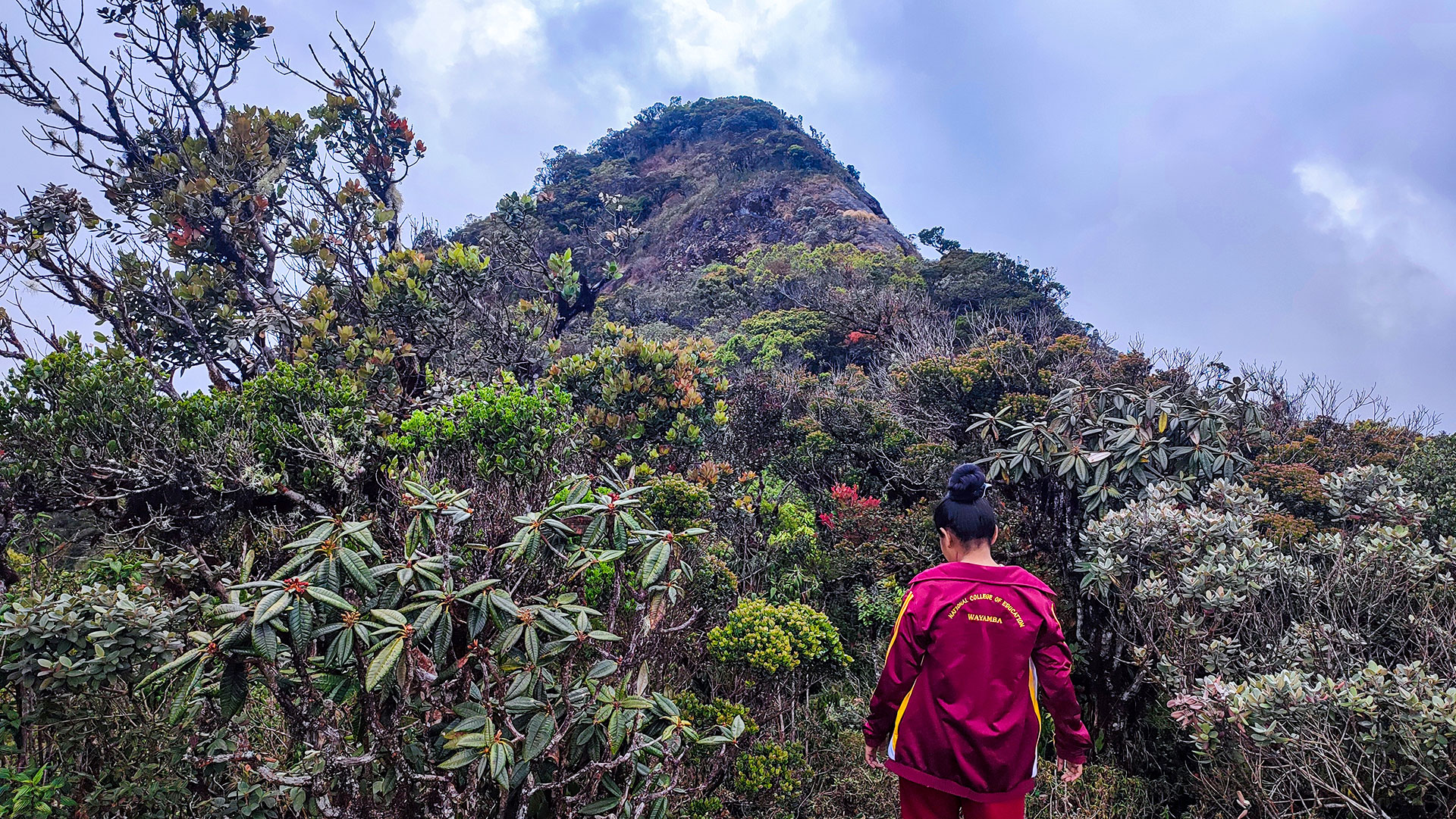
After reaching the first peak, hikers continue along a marked ridge trail to the second peak, which offers panoramic 360-degree views across the Knuckles range. From here, the remaining peaks can be reached within about an hour along an exposed ridge.
The trek involves steep climbs, forest sections with low branches, misty ridge walks, and occasional leech presence. It is a rewarding hike for those seeking mountain scenery and wilderness experience within the UNESCO-listed Knuckles Conservation Forest.
Gallery
🧭 How to Get There
📍 Location
Gomara, Knuckles Conservation Forest, Kandy / Matale District
🚗 How to Reach
- From Colombo (~158 km • ~6 h)
🧭 Select your starting point
Click markers to open locations in Google Maps
Travel Guide
Travel Tips
- Fill water bottles at Knuckles Falls - no water sources beyond this point.
- Wear sturdy hiking shoes due to loose rocks and steep sections.
- Leech protection is recommended, especially in wet conditions.
- Start early to avoid mist blocking summit views.
- Carry back all garbage - this is a protected conservation forest.
Safety Notes
Please read before visiting
- Trail includes steep ascents and loose soil.
- Ridge sections can be misty - watch your footing.
- Dense forest canopy limits visibility in some sections.
- Do not stray from the marked trail.
Nearby Destinations
 Waterfall
Diyakerella Waterfall
Diyakerella Waterfall is a 45 m high waterfall located in Meemure village in Kandy District, flowing through dense jungle beneath the Knuckles mountain range.
View Details
 Waterfall
Huluganga Waterfall
Huluganga Waterfall (Huluganga Ella) is a 75 m high cascade in Kandy District, originating from the Knuckles mountain range and flowing toward Victoria Reservoir.
View Details
 Viewpoint
Kalabokka 360 Upper Division Viewpoint
Kalabokka 360 Upper Division Viewpoint is a high-altitude lookout in the Knuckles Conservation Forest, renowned for its all-round views over steep valleys, village settlements, and rolling highland terrain.
View Details
Explore More Hiking Trails
 Hiking Trail
Hawagala Mountain
Hawagala Mountain is a prominent peak near Belihuloya in Ratnapura District, known for its challenging hike and wide summit views over surrounding mountains and valleys.
View Details
 Hiking Trail
Kirigalpoththa
Kirigalpoththa is Sri Lanka's second highest mountain and the tallest peak open to public access, located in Horton Plains National Park.
View Details
 Hiking Trail
Adam's Peak - Hatton (Nallathanniya) Trail
The Hatton-Nallathanniya trail is the most used route to Adam's Peak (Sri Pada), offering a well-paved 5 km ascent to the summit.
View Details