Hawagala Mountain
A steep and rewarding mountain hike near Belihuloya, offering panoramic views over Sabaragamuwa's lush highlands.
Distance
Difficulty
Best Time to Visit
Entrance Fee
Overview
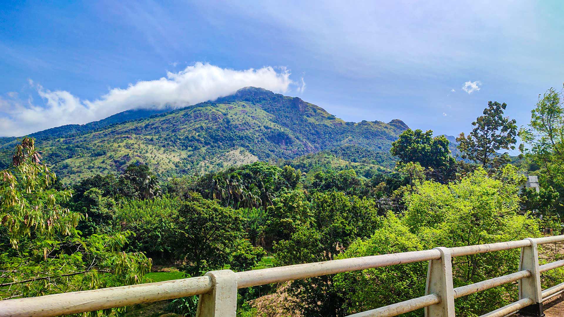
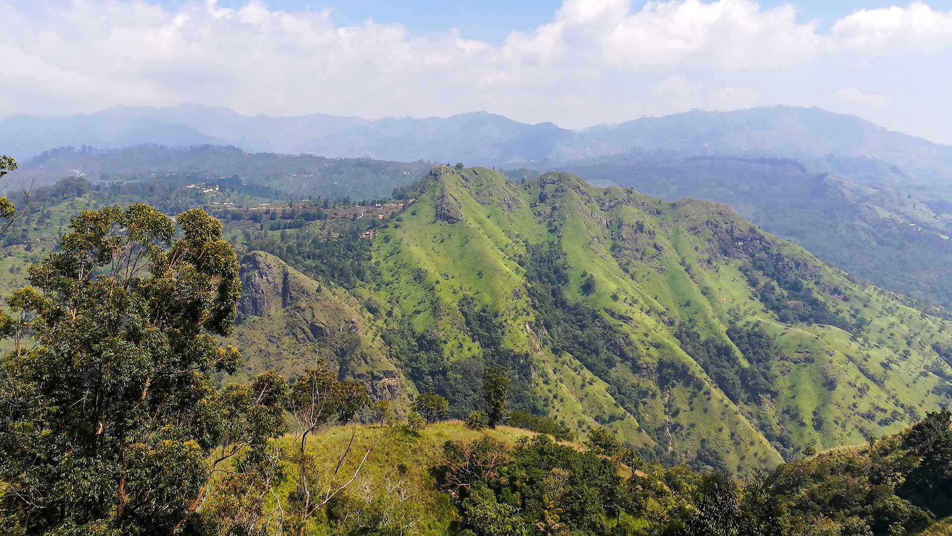
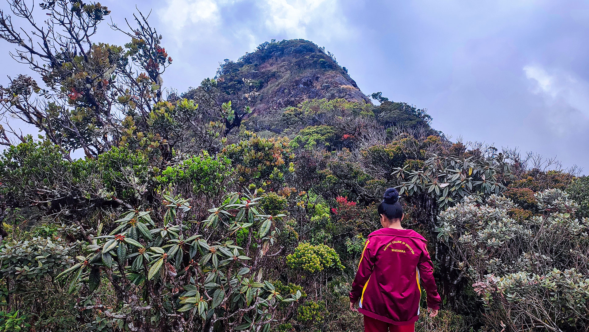
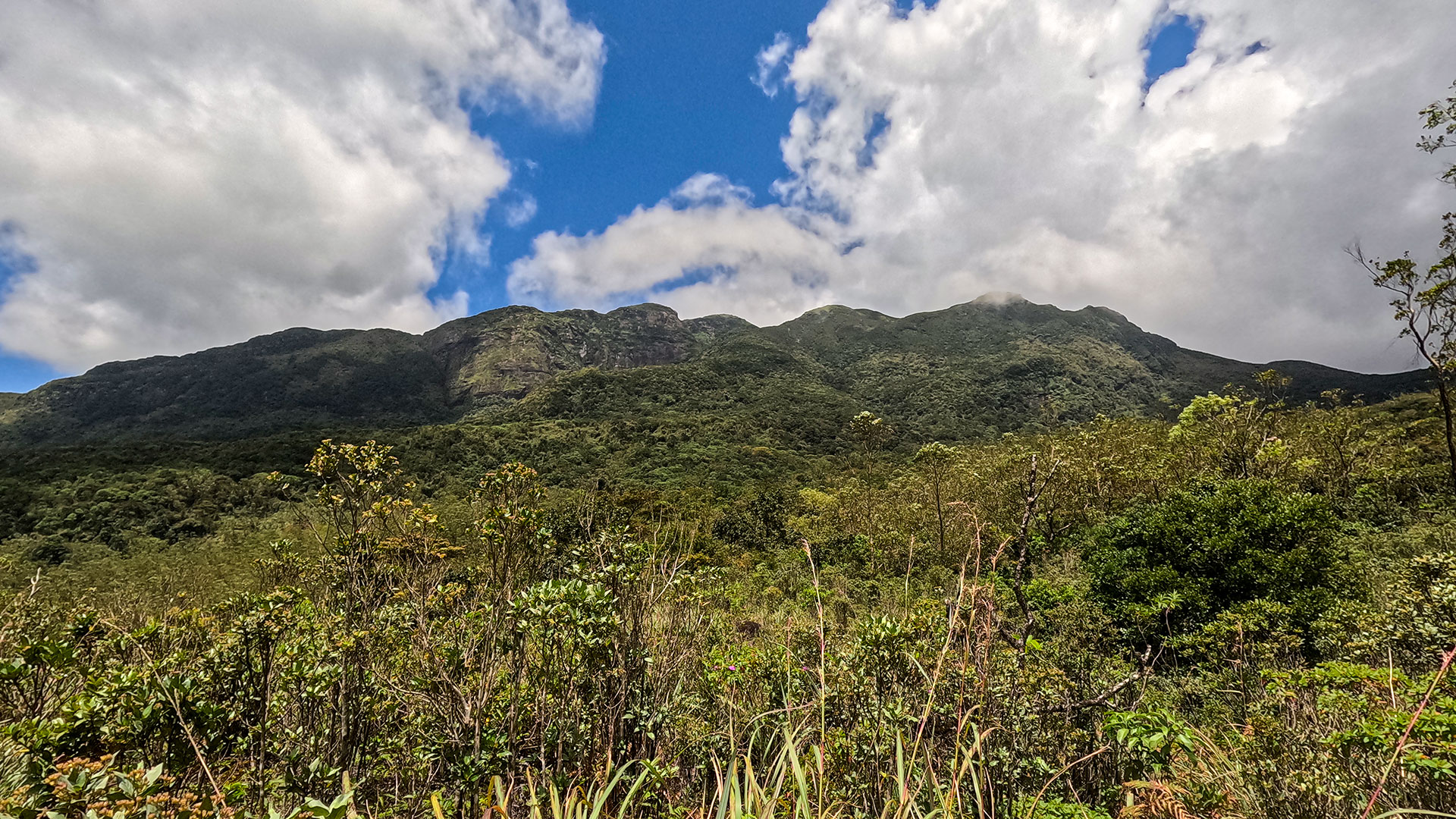
Hawagala Mountain is a striking peak located near Belihuloya in the Ratnapura District, within Sri Lanka's Sabaragamuwa Province. Rising prominently above the surrounding landscape, the mountain is easily recognizable by its steep, rugged profile and offers one of the most rewarding hiking experiences in the region.
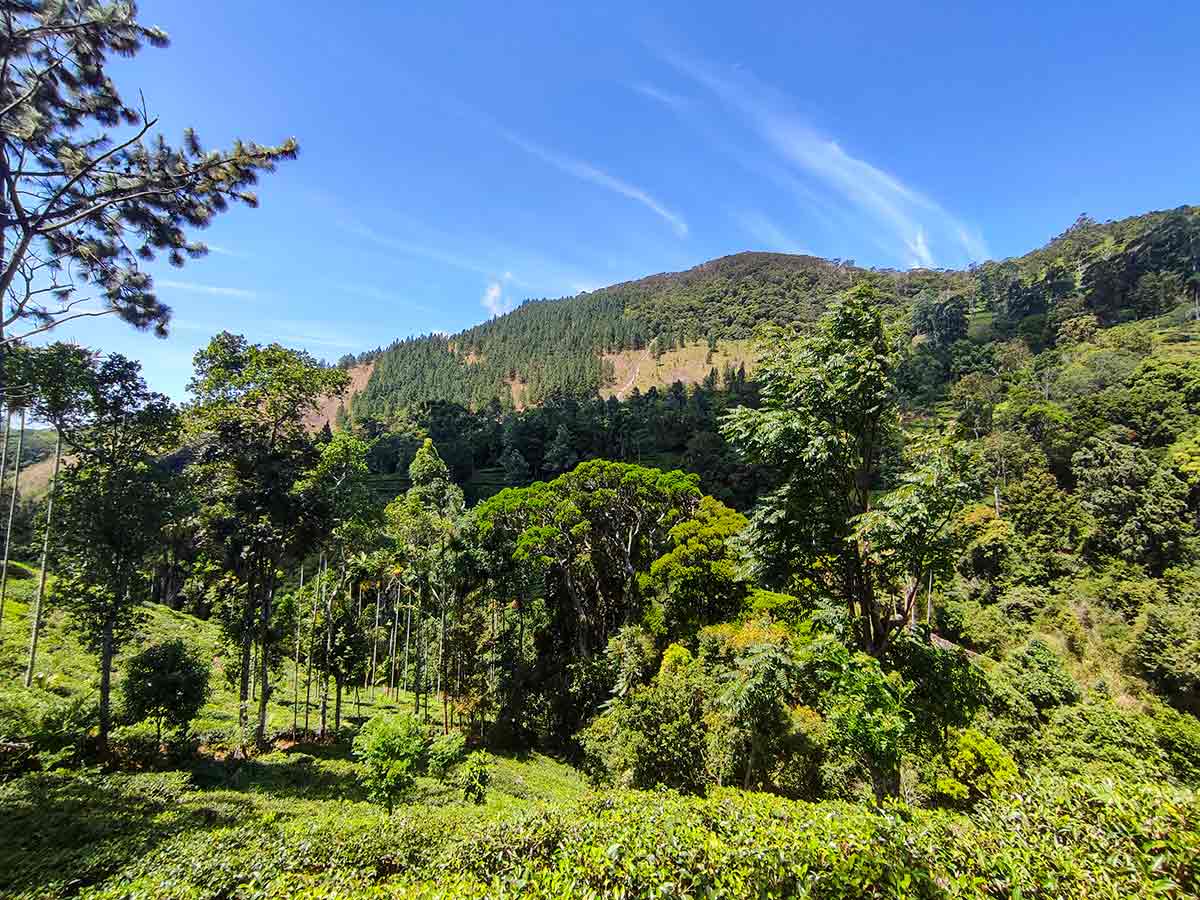
The hike to Hawagala is considered moderately difficult to challenging due to its steep incline, particularly near the summit. The trail passes through a mix of paddy fields, forest patches, and rocky sections before reaching the exposed rock summit. The final climb can be demanding but does not require technical skills.
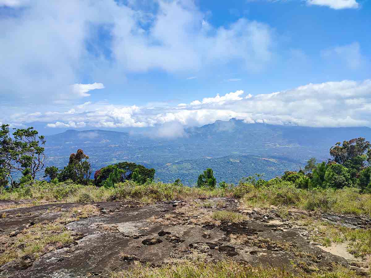
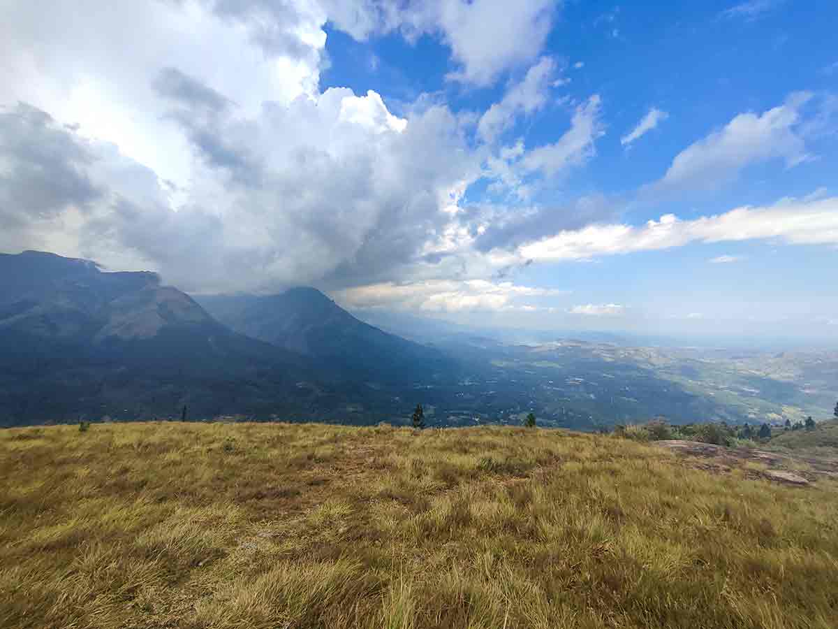
From the top, hikers are rewarded with panoramic views across the Belihuloya area, including surrounding landmarks such as NonPareil Estate, Adara Kanda, and distant highland ranges toward Horton Plains. On clear days, the scenery stretches across lush green valleys and rolling mountains, making the climb worthwhile.
Due to its scenic surroundings and relatively short access distance from Belihuloya, Hawagala has become a popular hiking destination among both locals and travelers seeking a less crowded alternative to more commercial trails.
Gallery
🧭 How to Get There
📍 Location
Belihuloya, Ratnapura District, Sabaragamuwa Province
🚗 How to Reach
- From Colombo (~150 km • ~5 h)
🧭 Select your starting point
Click markers to open locations in Google Maps
Travel Tips
- Start early morning for clear summit views and cooler temperatures.
- Wear proper hiking shoes - sections of the trail are steep and rocky.
- Carry enough drinking water as there are no facilities on the trail.
- Check weather conditions before starting - visibility can drop with mist.
- Consider hiring a local guide if unfamiliar with the route.
Safety Notes
Please read before visiting
- The final section to the summit is steep and can be slippery after rain.
- Rock edges at the summit are exposed with no safety barriers.
- Watch for leeches in forest sections during wet weather.
- Avoid hiking during heavy rain or strong winds.
- Mobile network coverage may be limited in some areas.
Nearby Destinations
 Viewpoint
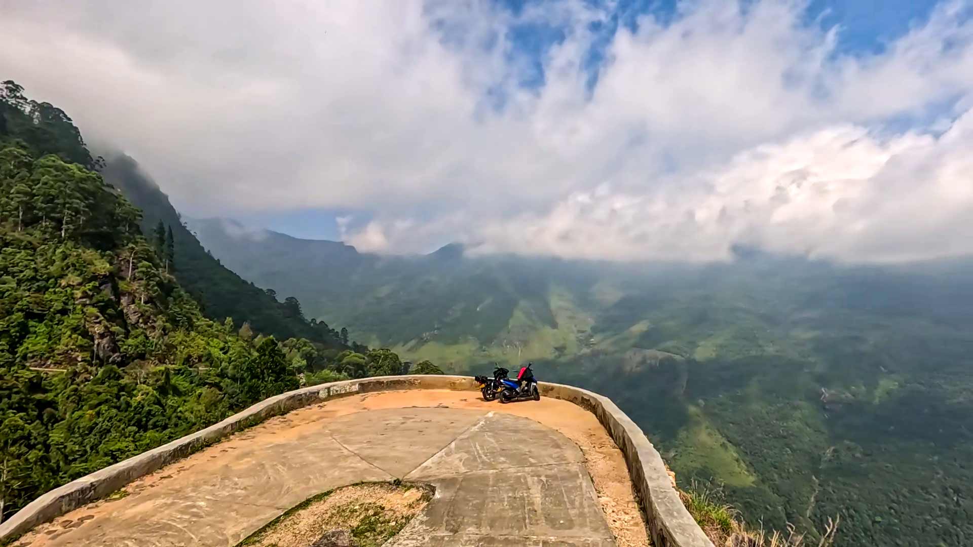
Baker's Bend
Baker's Bend is a high-altitude viewpoint in Nonpareil Estate near Belihuloya, known for its sharp curve, steep ascent, and sweeping views of surrounding mountain ranges and reservoirs.
View Details
 Waterfall
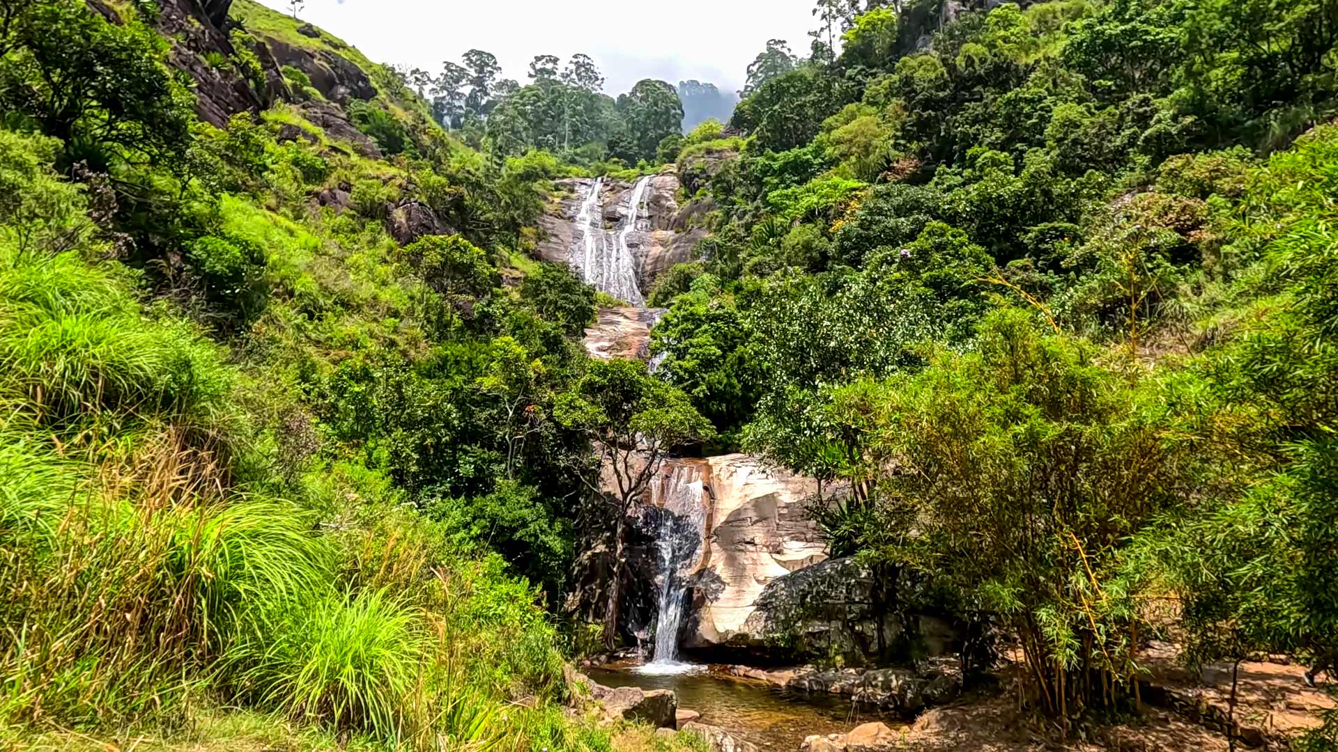
Nonpareil Estate Falls
Nonpareil Estate Falls is an approximately 45 m high stepped waterfall formed by Hirikatu Oya, located within Nonpareil Estate near Belihuloya in Ratnapura District.
View Details
 Waterfall
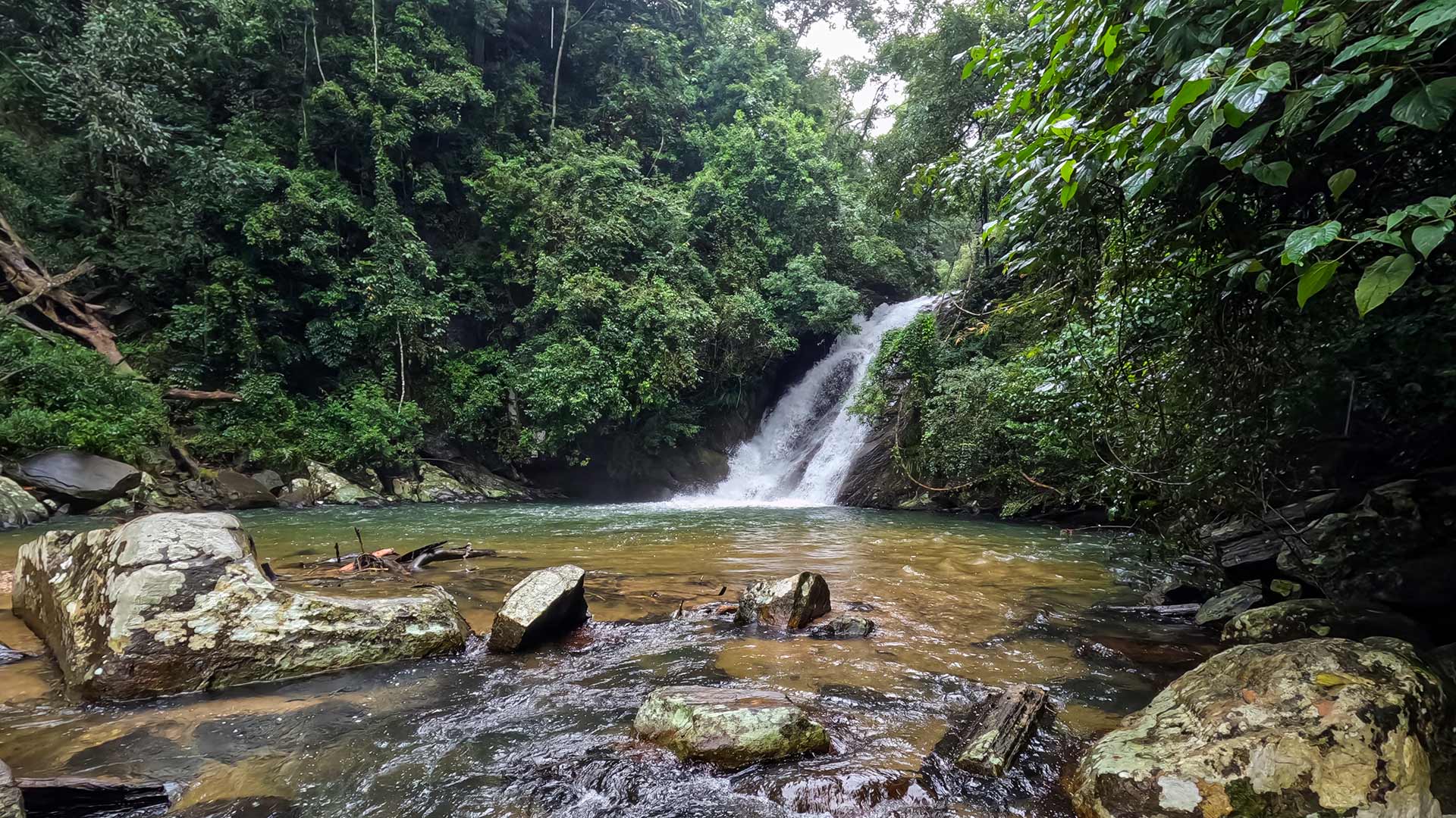
Bolthumbe Ella (Aliya Wetuna Ella)
Bolthumbe Ella, also known as Aliya Wetuna Ella, is an 8 m high waterfall near Bolthumbe in the Balangoda area, accessible via a short jungle walk along Bothumba Oya.
View Details
Explore More Hiking Trails
 Hiking Trail
Ella Rock
Ella Rock is a scenic hiking trail near Ella town, known for its rewarding summit views and varied terrain through railway tracks, tea estates, and forest paths.
View Details
 Hiking Trail
Kirigalpoththa
Kirigalpoththa is Sri Lanka's second highest mountain and the tallest peak open to public access, located in Horton Plains National Park.
View Details
 Hiking Trail
Knuckles 05 Peak - Bambarella Trail
The Bambarella Trail, also known as Dawatagala Knuckles Natural Trail, is a moderate hike in the Knuckles Conservation Forest leading to the 05 Peak ridge.
View Details