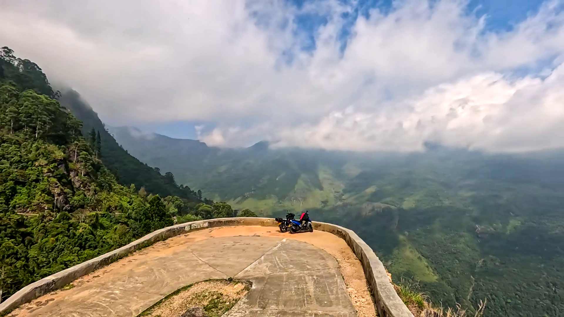
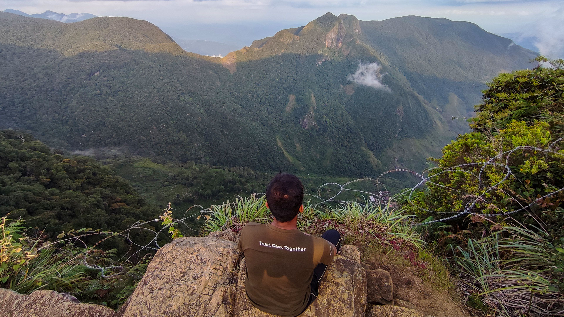
Baker's Bend
A dramatic horseshoe-shaped mountain bend in Nonpareil Estate, offering panoramic views across Sabaragamuwa highlands.
Distance
Difficulty
Best Time to Visit
Entrance Fee
Overview
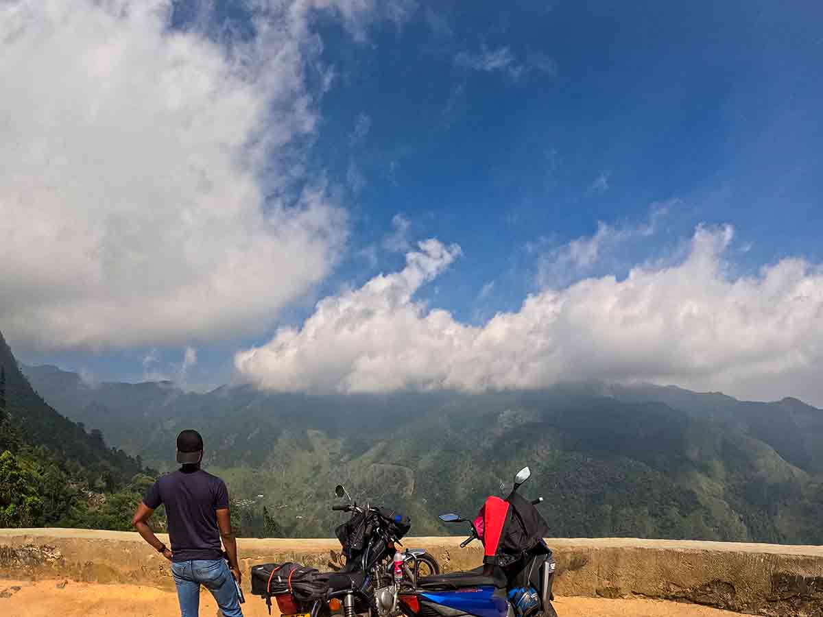
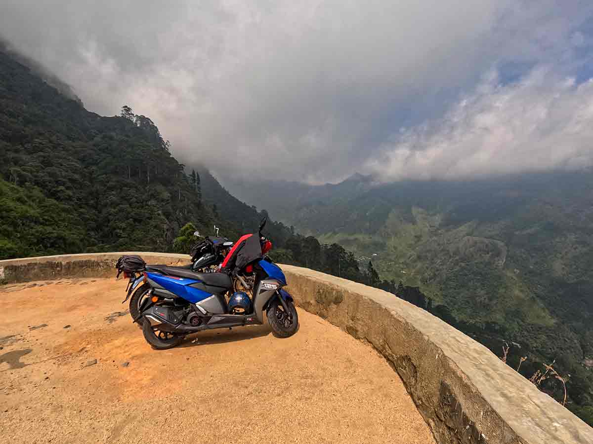
Baker's Bend is one of the most striking highland viewpoints located within Nonpareil Estate near Belihuloya in the Ratnapura District. The viewpoint sits on a dramatic horseshoe-shaped bend along a steep estate road that climbs rapidly through the mountains.
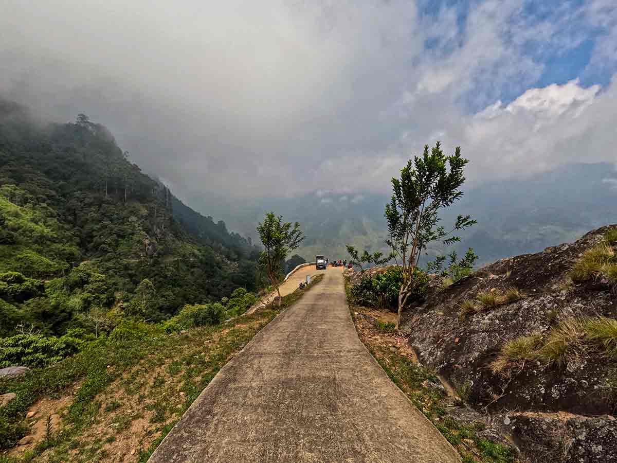
The road to Baker's Bend gains over 900 metres in elevation within a short distance, making the journey itself a scenic experience. The route is rugged and narrow, with frequent sharp turns, and is best suited for motorbikes, 4WD vehicles, or hiking.
At approximately 1,530 metres above sea level, the viewpoint offers expansive panoramic views. On clear days, mountain ranges such as Balathuduwa, Gommolikanda, and Adarakanda are visible, while distant reservoirs including Samanala Wewa and Udawalawe can be seen toward the lowlands.
The bend is named after a British estate manager, William Baker, and local folklore links the name to an incident involving his horse. Today, it remains one of the most popular scenic stops along the Nonpareil mountain route.
The surrounding area borders Horton Plains National Park, and access beyond estate boundaries is restricted.
Gallery
🧭 How to Get There
📍 Location
Nonpareil Estate, Belihuloya, Ratnapura District, Sabaragamuwa Province
🚗 How to Reach
- From Colombo (~157 km • ~5 h)
🧭 Select your starting point
Click markers to open locations in Google Maps
Travel Tips
- Visit early morning or late afternoon for the clearest views.
- Mist can cover the area by midday - plan accordingly.
- Use a 4WD vehicle or motorbike due to rough road conditions.
- Combine with Hawagala hike and Nonpareil Estate Falls.
- Carry water and essentials - no facilities along the route.
Safety Notes
Please read before visiting
- Road is steep, narrow, and has sharp bends - drive cautiously.
- No safety barriers at the viewpoint edge.
- Avoid traveling during heavy rain due to slippery conditions.
- Do not attempt to enter restricted areas toward Horton Plains.
Nearby Destinations
 Waterfall
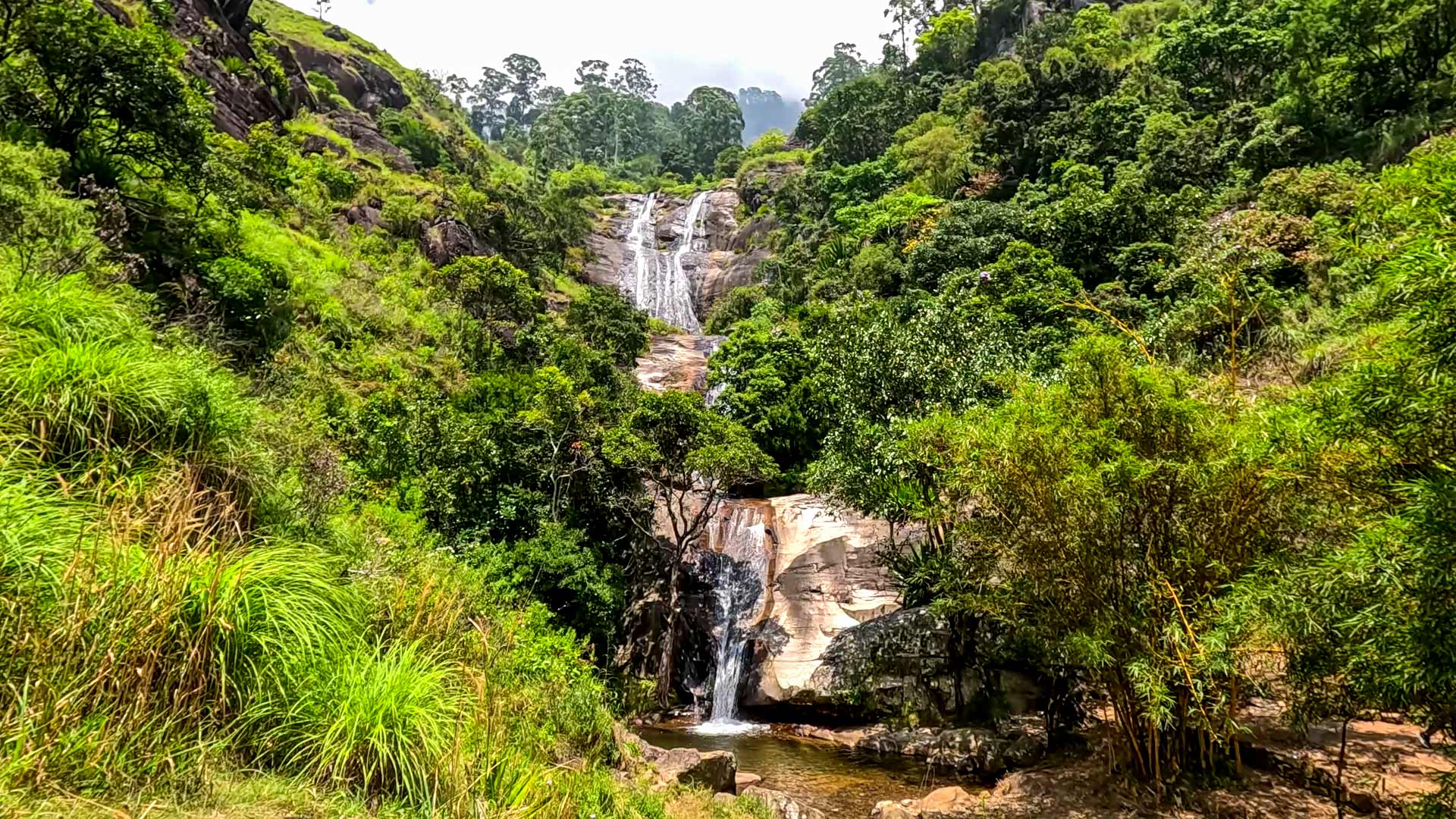
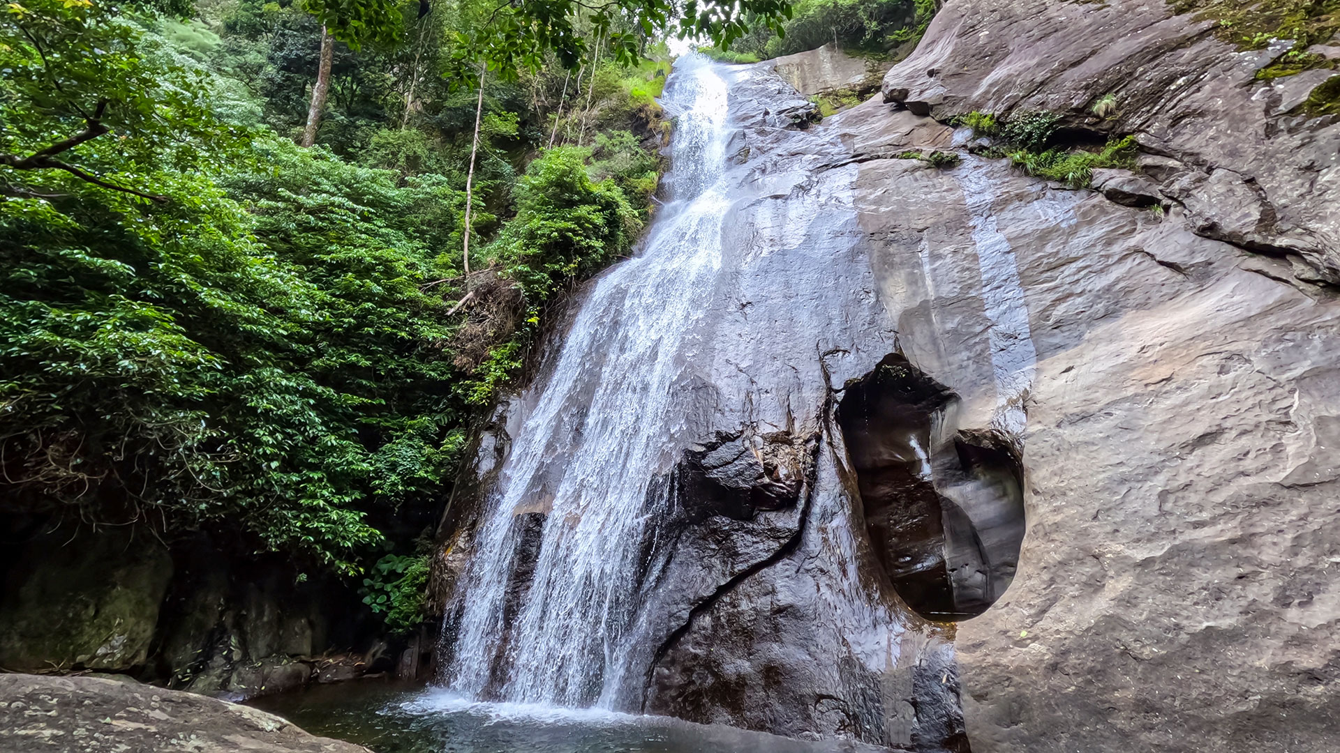
Nonpareil Estate Falls
Nonpareil Estate Falls is an approximately 45 m high stepped waterfall formed by Hirikatu Oya, located within Nonpareil Estate near Belihuloya in Ratnapura District.
View Details
 Viewpoint
The Great World's End - Horton Plains
The Great World's End is a sheer escarpment inside Horton Plains National Park, offering one of the most breathtaking panoramic views in Sri Lanka.
View Details
 Waterfall
Yahalathenna Waterfall
Yahalathenna Waterfall (also spelled Yahalatenna or Yahala Thenna) is a 90 ft high waterfall near Walhaputenna in Haldummulla, offering a quiet alternative to Bambarakanda.
View Details
Explore More Viewpoints
 Viewpoint
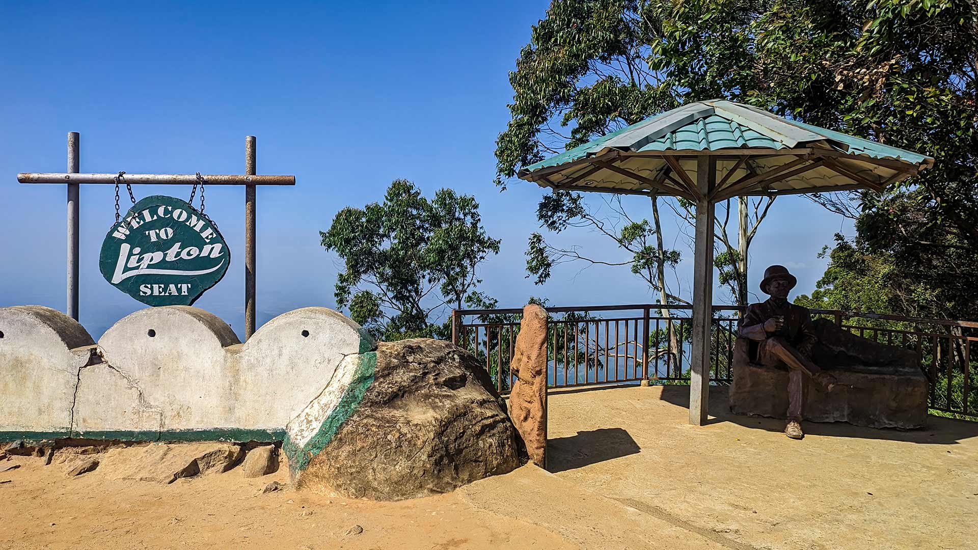
Lipton's Seat (Haputale)
Lipton's Seat is one of Sri Lanka's most iconic viewpoints, located high above the Dambethenne Tea Estate with sweeping panoramic views.
View Details
 Viewpoint
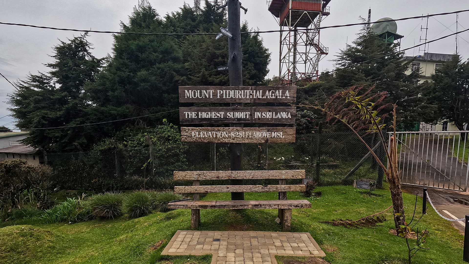
Pidurutalagala (Mount Pedro)
Pidurutalagala, also known as Mount Pedro, is the highest peak in Sri Lanka located near Nuwara Eliya, accessible by road and known for its cool climate and panoramic highland views.
View Details
 Viewpoint
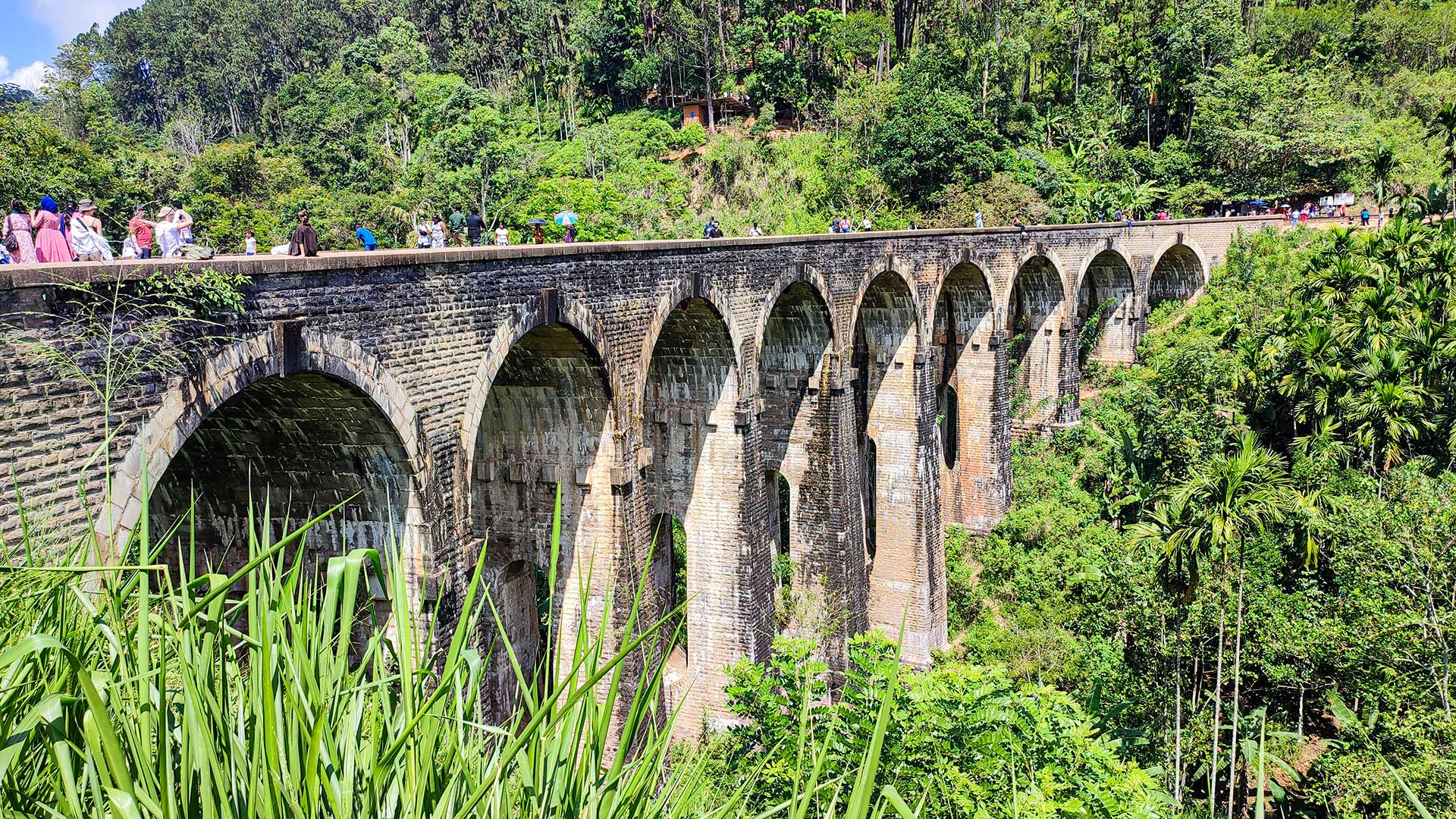
Demodara Nine Arch Bridge
The Nine Arch Bridge is a historic railway viaduct in Ella, built entirely with stone and brick, offering one of Sri Lanka's most photographed viewpoints.
View Details